If travelling, exploring and mountains have always thrilled you and give you that kick then Trekking is adventure for you. It serves as the ultimate recipe for a perfect adventure getaway. India is blessed with snow capped mountain ranges and alluring valleys which offers some extraordinary treks in India. These treks are perfect for nature lovers and adventure enthusiasts. Indian Himalayas offers some magnificent treks in the states of Jammu & Kashmir, Himachal Pradesh, Uttarakhand, and Sikkim. Whether it is summer or winter, Himalayan treks are offered throughout the year. With over hundreds of trekking routes, this magnificent range attracts experienced as well as amateur trekkers.
These treks are unique in their own ways but it is clear that some treks are better than the others and attracts more trekkers due to its unique trails or views. Here, I have classified 30 best Himalaya trekking trails under the category of states which will help you to narrow down your choices quickly.
Best Treks in Uttarakhand
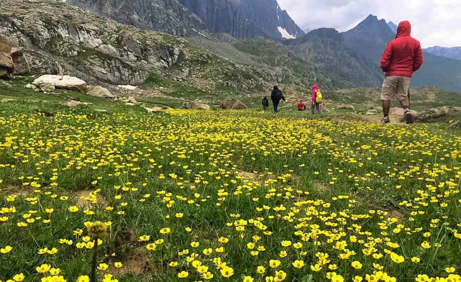
Valley of Flowers Trek
Trek Highlights
- View of hidden colourful valley of Flowers.
- Home of rare varieties of flourishing flowers such as golden lily, marigold, poppy, daisies, and anemone.
- Rich fauna coverage but with low density.
- View of high altitude lake Hemkund.
- World’s highest Gurudwara, the Hemkund Sahib
Key Facts
- Region : Garhwal Himalayas, Uttarakhand
- Duration : 6 Days
- Difficulty : Moderate
- Trekking Distance : 47 Km
- Altitude : 12,000 ft
- Best Time: July to September
- Trip Starting Point : Govindghat (20 Km before Badrinath)
- Nearest Railway Station : Haridwar
- Nearest Airport: Dehradun
Located in Chamoli district of Uttarakhand, Valley of Flower National Park is a World heritage site, discovered in 1931. This park is famous for its hidden colourful flowers, animals and snow capped mountain peaks. Trek to valley of flowers is of moderate one which will be rewarded with the exhilarating views of magnificent valley.
This trek is famous for its mythological connection as it is said that Lord Hanuman found Sanjeevani here. One can reach this mystical valley by trekking for 3 days by crossing through Govindghat, Hamkund Sahib, and Ghangaria. This trek is famous for those who are nature lovers and adventure freaks.
Trek Route: Haridwar – Govind Ghat – Ghangaria (via Poolna) – Valley of flowers and back – Hemkund Sahib and back to Ghangaria – Govind Ghat
– Must Read: Top Ten Treks in Uttarakhand
Har Ki Dun Trek
Trek Highlights
- One of the least explored and beautiful treks in Garhwal Himalayas.
- View of snow capped mountain peak of Swargarohini.
- Camping under the night sky
- Duryodhana Temple
Key Facts
- Region : Garhwal Himalayas, Uttarakhand
- Duration : 7-8 Days
- Difficulty : Easy to Moderate
- Trekking Distance : 47 Km
- Highest Altitude : 11,675 ft
- Best Time : April to June & August to December
- Trip Starting Point : Sankri
- Nearest Railway Station : Haridwar
- Nearest Airport : Dehradun
Also known as the hanging valley, Har ki Dhun Valley is famous for its intact and untouched beauty. Mountainous beauty and lush greenery will awe you. This trek is of moderate one and also known as beginners trek. Accessible during both summers and winters, this trek can be done through Govind National Park.
The trek starts from Sankri base camp and you have to trek 5hours a day to cover a distance of 47 Km. The trek will pass through beautiful villages, orchid fields, pine and rhododendron forests. Swargarohini and Jaundhar glaciers can also be viewed during trek to Har ki Dhun. This seven days trek will give you the perfect trekking experience with mesmerizing views.
Trek Route: Dehradun – Sankri (drive) – Taluka (drive) – Osla (trek) – Har ki Dun – Jaundhar Glacier – Har Ki Dun camp – Osla – Sankri – Dehradun
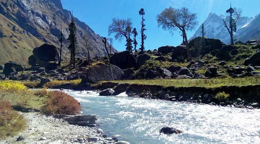
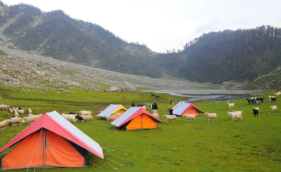
Roopkund Trek
Trek Highlights
- Camping near tumbling river and under the clean sky. Breathtaking campsites
- Trek through alpine forests, Oak and Rhododendron forests.
- Witness the attenuate flora and fauna of this region.
- Witness the splendid view of Mt. Trishul, Chaukhamba range, Kedarnath, and Neelkanth peak.
- Twin meadows Ali Bugyal and Bedni Bugyal
Key Facts
- Region : Garhwal Himalayas, Uttarakhand
- Duration : 9 Days
- Difficulty : Moderate
- Trekking Distance : 53 Km
- Highest Altitude : 16,500 ft
- Best Time : May to November
- Trip Starting Point : Lohajung
- Nearest Railway Station : Haridwar or Kathgodam
- Nearest Airport : Dehradun
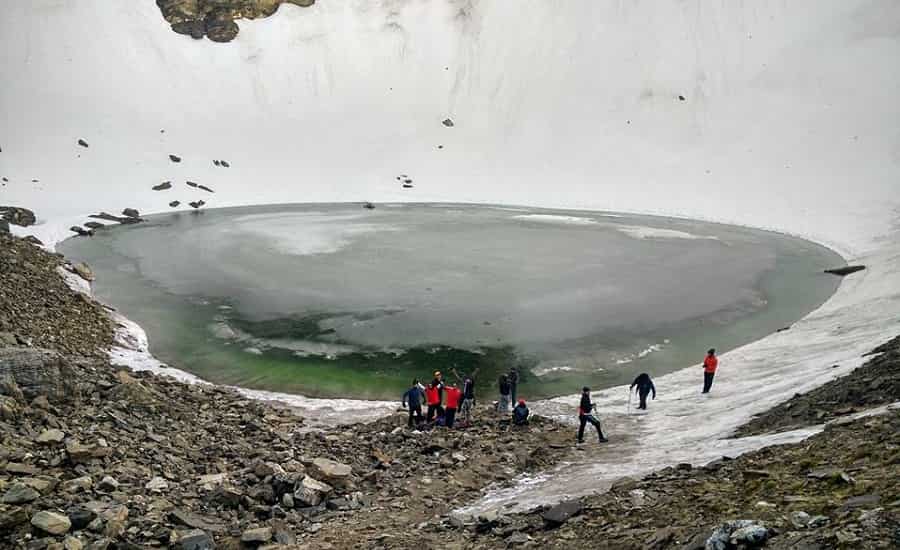
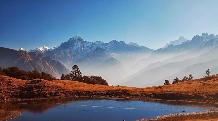
Roopkund, a mystery lake in Uttarakhand is a water body nestled in the lap of Mt Trishul. At an altitude of 16,500 ft, this lake is the home of human skeletons lying at the base of the lake which can be seen when the snow melts. A moderate trek, the trek routes passes through tumbling rivers, ridges, lush green forests and splendid meadows.
This is the must do trek due to its magnificent trekking trails. You have to climb 4000 ft in four days i.e. from 8,000 ft to 16,000 ft. One of the most popular trek of India, this is the perfect trek for photographers.
Trek Route: Kathgodam – Lohajung – Wan (drive) – Ghairoli Patal – Bedni Bugyal – Bedni Top – Patar Nachauni – Bhagwabasa – Roopkund – Junargali – Return to Patar Nachauni (via Bhagwabasa) – Lohajung (via Bedni and Wan) – Kathgodam
Auden’s Col Trek
Trek Highlights
- A passage through a handful of remote Garhwali villages.
- Rudragaira peak (5818m) and Khatling glacier
- Camping on snow drifted forest floor.
- Gangotri – the origin point of River Ganga.
- Jogin group of peaks, Bhagirathi group of peaks and Kedar Dome.
- Various temples which reflect the religious importance of Garhwali region.
Key Facts
- Region : Central Region of Garhwal Himalayas, Uttarakhand
- Duration : 16 Days
- Difficulty : Challenging
- Trekking Distance : 115 Km
- Highest Altitude : 5,490m (18,012ft)
- Best Time : Mid May to October except July and August
- Trip Starting Point : Haridwar
- Nearest Railway Station : Haridwar
- Nearest Airport : Dehradun
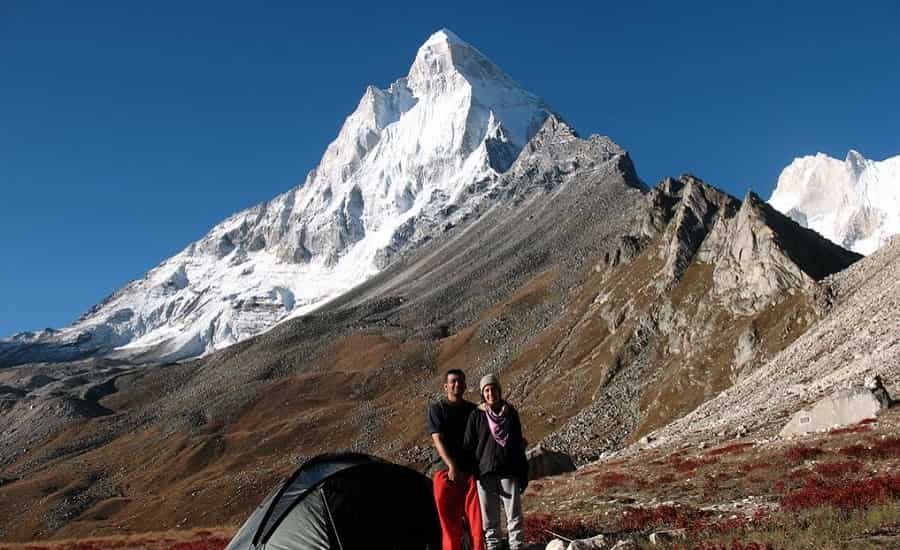
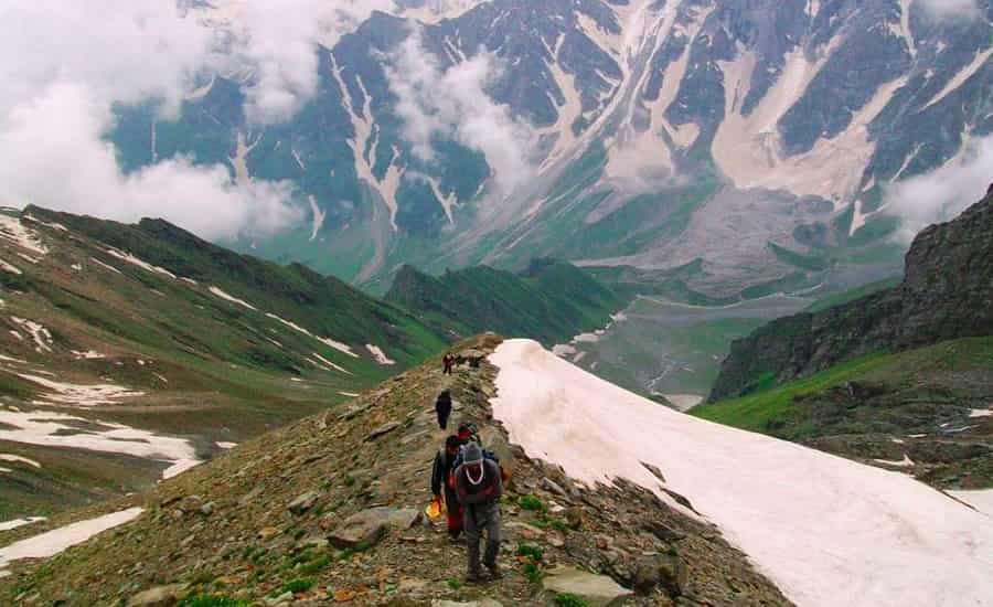
Situated in the Central Garhwal region, Auden’s Col is a high mountain pass which connects the mountain peaks Jogin I (6465m) and Gangotri III (6580m) and is at an altitude of 5490m. The trek route from Gangotri to Kedarnath and Gauri Kund via Auden’s Col and Khatling Glacier is known as Auden’s Col Trek. Auden’s Col is affably one of the most challenging and least explored treks in Garhwal Himalayas. This pass connects the pilgrim centres of Gangotri and Kedarnath. Passes through high altitude spots, dangerous ridges, narrow cliffs, stony and snowy paves, Auden’s Col trek is a dream trek for almost every trekker.
Satopanth Lake Trek
Trek Highlights
- Witness surreal high altitude green lake Satopanth
- Walk over a natural rock bridge, Bheem Pul
- Watch the mesmerizing Vasudhara waterfalls
- Hike to Dhano Glacier
- Walk through the last village of India, ‘Mana’
- Panoramic views of Chaukhamba, Neelkanth, Balakuni, Parvati Swargarohini others mountain peaks
- Camping by the Satopanth Lake
Key Facts
- Region : Garhwal Himalayas, Uttarakhand
- Duration : 7 Days/6Nights
- Difficulty : Moderate-Tough
- Best Time: Mid May to June and September to October
- Trekking Distance : 50 Km
- Highest Altitude : 15,420 ft
- Trip Starting Point : Haridwar/Rishikesh
- Nearest Railway Station : Haridwar
- Nearest Airport : Dehradun
- Atm: ATMs are there in Joshimath and Badrinath.
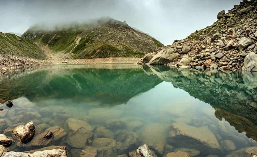
The trip to Satopanth Lake starts from Mana village, and it will be roughly 3 km up from Badrinath in 3,300 meters. Badrinath is one of those Hindu pilgrimage sites favourite for hosting a shrine dedicated to Lord Vishnu. The road from Mana contributes to Vasudhara through Bheem Bridge. The critical attractions on this trip would be the Indo-Mongolian tribe setup in Mana village along with Vasudhara drops. The trek to Satopanth has been gone to Laxmi Van en course a dense woods and then the trail snakes into the area of Satopanth Lake. The trek down to Badrinath follows the same route, and afterwards, the trekking excursion to Satopanth Lake contributes to Rishikesh.
Kuari Pass Trek
Trek Highlights
- A passage through a handful of typical Garhwali villages.
- A day of easy clamber through oak and rhododendron forests.
- Camping on snow drifted forest floor.
- Grand views of 4 peaks of Chaukhamba, Neelkanth, Mana, Kamet, Hathi, Ghodi, Trishul, Nanda Ghunti, Nanda Devi, and Dronagiri.
- The lush green Gorson meadow.
- Witness an ancient trading route.
- Tali Lake.
Key Facts
- Region : Garhwal Himalayas, Uttarakhand
- Duration : 6 Days
- Difficulty : Easy – Moderate
- Trekking Distance : 33 Km
- Highest Altitude : 12,516 ft
- Best Time: November to June
- Average Temperature: Day time: 13°C-18°C; Night time: -3°C-4°C
- Trip Starting Point : Haridwar
- Nearest Railway Station : Haridwar
- Nearest Airport : Dehradun
The Kuari Pass is counted amongst the top ten passes located in the Himalayan mountain range. The pass is also known as Curzon’s trail since it was visited by Lord Curzon quite a few numbers of times. This pass is quite popular amongst the American and the European travelers. The main fascination of this pass is that from here one can view the highest and the Twin peaks of Nanda Devi which is located at an altitude of 7816 metres, Hathi Parbat, East Summit, and Dronagiri, Ghori Parbat from this pass.
As you are on your way to reach the top of the Kuari pass you will see the very unique flora and fauna of the Himalayan region, which comprises of the Oak, Rhododendron and the Deodar forests. The maximum height that an individual can reach is 4268 meters. As you go along the route, you will feel that the air is so fresh and rejuvenating and the scenery is simply desirable. You will also cross Auli and Joshimath. Auli is the place well known for skiing and is visited by many people especially during the winters to enjoy skiing in the beautiful snow clad mountains. You can also enjoy and experience rock climbing and moon light trekking.
– Must Read: Popular Winter Treks in India
Gangotri Tapovan Trek
Trek Highlights
- A passage through a handful of typical Garhwali villages.
- View of Gaumukh, the source of mighty River Ganga.
- Astonishing view of Gangotri Base camp surrounded by snow capped mountains, deodar forests.
- Witness the splendid view of Bhagirathi peaks from Chirbasa.
- View of various snow capped mountains and distant valleys.
Key Facts
- Region : Garhwal Himalayas, Uttarakhand
- Duration : 8 Days
- Difficulty : Moderate – Difficult
- Trekking Distance : 33 Km
- Highest Altitude : 14,202 ft
- Best Time: Mid April to June and August to Mid October*
- Average Temperature: Day time: 12°C-17°C; Night time: 2°C-7°C
- Trip Starting Point : Gangotri
- Nearest Railway Station : Haridwar
- Nearest Airport : Dehradun
One of the most exciting and adventurous treks, Gangotri Tapovan Trek is full with trill, adventure and peace of mind. It is an ideal trek for those who want to indulge in religious peace as well as thrilling adventure at the same time. The trek passes through forests, passes, scenic meadows and rugged terrains.
The trek starts from Gangotri Base Camp which is accessible from Uttarkashi. You can witness the spectacular view of Gaumukh Glacier which is one of the main important sources of River Ganga. From here you can see the magnificent peaks of Gangotri Group – Shivling, Meru, Bhagirathi III, and Thalay Sagar.
Trek to Tapovan which is located at the foothills of the Shivling Peak, is a tough trek. This Gangotri Tapovan trek can take you to some of the untouched beauty of the region.
Trek Route: Haridwar – Uttarkashi – Gangotri (drive) – Bhojbasa – (trek) – Gomukh – Tapovan – Bhojwasa – Gangotri – Uttarkashi – Haridwar
Chopta Chandrashila Trek (with Tungnath)
Trek Highlights
- Summit views of Chaukhamba, Trishul, Nanda Devi, Neelkanth, Dunagiri, and Kedardome etc.
- One of the best forest trails with varieties of jungles.
- Bird Watching
- Low altitude trek with scenic meadows and waterfalls.
- One of the highest temples in the world, the Tungnath Temple
Key Facts
- Region : Uttarakhand
- Duration : 5 Days
- Difficulty : Easy – Moderate
- Trekking Distance : 30 Km
- Highest Altitude : 12,083 ft
- Best Time: September to November and January to March
- Average Temperature: Day time: 8°C-15°C; Night time: -5°C-3°C
- Trip Starting Point : Sari Village (6 hrs drive from Haridwar)
- Nearest Railway Station : Haridwar
- Nearest Airport : Dehradun
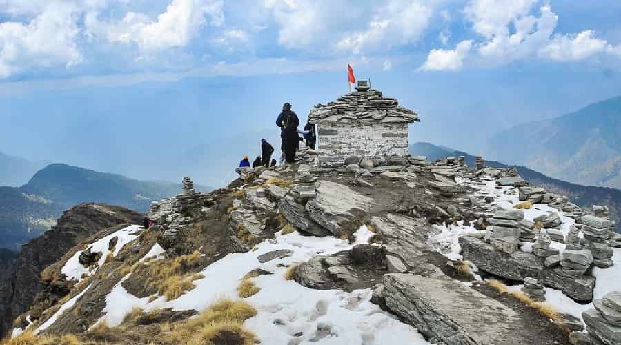
Chopta, a village located 36 Km from Gopeshwar and 254 Km from Rishikesh is an important place for both Chandrashila trek and Tungnath trek. From Chopta, you can reach Chandrashila peak by 1 km trek. This trek is popular among all kind of trekkers especially in summer when the entire area is filled with rhododendron flowers.
Chopta Chandrashila Trek starts from Sari Village and passes through magnificent valley, lush green forests, the alluring Deorital Lake and views of various snow capped mountain peaks. This trek is of moderate one and can be done throughout the year.
Trek Route: Haridwar – Sari – Deorital – Chopta – Tungnath – Chandrashila Peak – Chopta – Haridwar
Dayara Bugyal Trek
Trek Highlights
- View of lush green meadows of Dayara
- Snow packed trail until mid April
- Dense and rich forest of Oak and Maple
- Panoramic view of Mt Srikanth, John Lee, Mt Bandarpoonch and Draupadi ka Danda
Key Facts
- Region : Uttarakhand
- Duration : 6 Days
- Difficulty : Easy – Moderate
- Trekking Distance : 50 Km
- Highest Altitude : 12,500 ft
- Best Time: May to June and September to October
- Average Temperature: Day time: 13°C-18°C; Night time: 7°C-12°C
- Trip Starting Point : Barsu (32 Km from Uttarkashi)
- Nearest Railway Station : Haridwar
- Nearest Airport : Dehradun
Dayara Bugyal, one of the highest and most beautiful meadows in the world, is located in the Garhwal Himalayas. This trek will lead you to this splendid meadow which is perfect trekking experience for nature lovers as well as adventure enthusiasts. This trek passes through scenic oak forests, snow capped mountain peaks, meadows and scenic grasslands.
Dayara Bugyal Trek starts from Barsu, a small hamlet which is 32 Km from Uttarkashi. This trek is not spoken of too often but it is one of the best treks as trekkers told.
Trek Route: Haridwar – Barsu – Dayara Bugyal – Dayara Bugyal Top – Barsu – Haridwar
Nag Tibba Trek
- Trek Highlights
- Climbing the Nag Tibba Peak.
- Astonishing views of the peaks of Bandarpoonch, Gangotri, Kedarnath etc.
- Nag Tibba Temple
- Packed with adventure activities
- A passage through a handful of scenic villages of remote Uttarakhand
- A day of lovely walk through oak, deodar and pine forests.
- Pretty meadows
Key Facts
- Region : Garhwal Himalayas, Uttarakhand
- Duration : 2 Days
- Difficulty : Easy
- Trekking Distance : 15 Km
- Highest Altitude: 9,910ft.
- Average Temperature: 16-25 degrees (days) and 8-16 degrees (nights) during March, 14-22 degrees (days) and 6-14 degrees (nights) between September and December
- Trip Starting Point : Dehradun
- Nearest Railway Station : Dehradun
- Nearest Airport : Dehradun
- Atm : ATMs are there in Mussoorie and Dehradun
Lends its name to the “Nag Tibba Range”, Nag Tibba (Serpent’s Peak) is the highest peak in the Nag Tibba range of the Garhwal Himalayas. Situated at an altitude of 3,022 m (9,915ft), Nag Tibba is around 57 Km from Mussoorie and lies in the foothills of the Tehri Garhwal region of Uttarakhand. Though it is comparatively less explored trail near Mussoorie but is a trekker’s delight and can easily considered as one of the best weekend treks from Delhi.
Nag Tibba Trek is perfectly suitable for beginners and children as there is no threat of Acute Mountain Sickness (AMS) and a thoroughly invigorating trek instead. The trek takes you through dense forests rich in flora and fauna and explored by trekkers and adventure enthusiasts for its panoramic beauty and high elevation. Nag Tibba presents stunning views of various peaks, ranging from the Bandarpoonch peak, the Gangotri group of peaks, Kedarnath peak in the north, Doon valley and the snow peaks of Changabang.
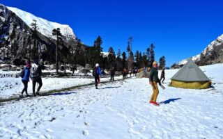
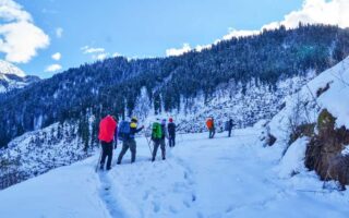
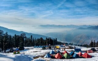
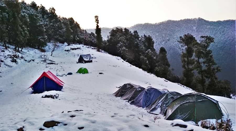
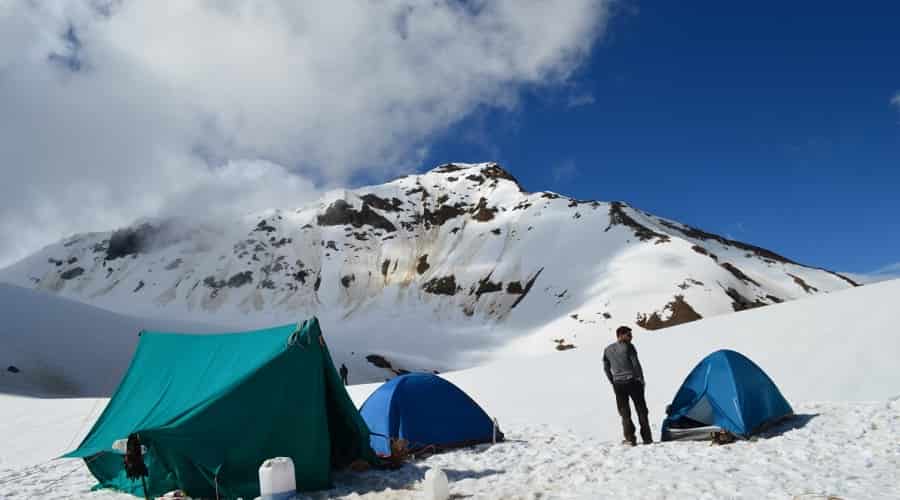
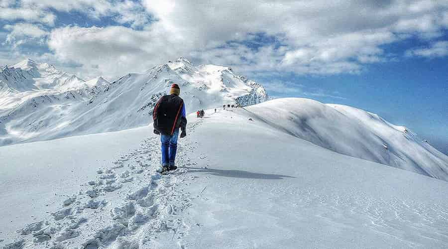
Kedarkantha Trek
Highlights
- One of the best winter treks in the country
- Witness the magnificent views of snow capped mountains, valleys and frozen ponds and lakes
- See the varieties of flora and fauna of the region
- Camping in the snow drifted floors
- Trekking trails passing through lush meadows, splendid streams, maple trees, and dense pine forests
Key Facts
- Region : Uttarakhand
- Duration : 7 Days
- Difficulty : Easy – Moderate
- Highest Altitude: 12,500 ft
- Trekking Distance: 26 Km
- Best Time : December to April
- Average Temperature: 8 °C -15°C (Daytime) and -5°C – 3°C (Night)
- Trip Starting Point : Sankri
- Nearest Railway Station : Dehradun
- Nearest Airport : Dehradun
One of the most beautiful and easiest treks in the Indian Himalayas, Kedar Kantha Trek is an ideal trek for the beginners. Due to its gradual and easier ascends and descends; this trek is perfect for those who want to start their trekking experience. This is a perfect winter trek when the valley is covered with snow. Visited by less number of trekkers, Kedarkantha is close to the Har Ki Dun valley.
Kedarkantha Trek starts from Sankri village and passes through rich and dense forests, meadows and several beautiful streams. After crossing 10,000 ft mark you will trek on the snow drifted floor full of pine trees. Kedarkantha Trek also consists of some of the most beautiful campsites in the Himalayas which is unique in its beauty. If you are nature lover and also want to trek on snow, then this is the perfect trek for you.
Trek Route: Dehradun – Sankri – Juda Ka Talab – Kedarkantha Base – Kedarkantha Peak – Hargaon Camp – Sankri – Dehradun
Best Treks in Himachal Pradesh
Hampta Pass Trek
Trek Highlights
- View of some of the mighty peaks of the Dhauladhar Range
- Famed Hampta Pass, doorway to the Lahaul
- Beautiful valleys of Chika and Bhalu ka Ghera
- Scenic forests of Deodars, firs and spruces
- Handful of picturesque Himachali villages
Key Facts
- Region : Himachal Pradesh
- Duration : 5-6 Days
- Difficulty : Moderate
- Trekking Distance : 34 Km
- Altitude: 14,600 ft.
- Best Time : June to September
- Average Temperature: 12 °C -20 °C (summer) and (-2) °C – 6°C
- Trip Starting Point : Manali
- Nearest Railway Station : Joginder Nagar Railway Station
- Nearest Airport : Kullu
Hampta Pass trek is the best choice for beginner with easy trail, splendid views of the glaciers, snow capped mountain peak, and alpine forests. This pass connects Lahaul and Kullu valleys and famed as the special pass in Himalayas. Passes through beautiful valleys, handful of Himachali villages and magnificent forests, this trek is a perfect Himalayan adventure.
Trek Route: Manali – Jobra (drive) – Chika – Balu Ka Ghera – Siagoru (via Hampta Pass) – Chatru – Chandratal – Manali (via Rohtang La)
Triund Trek
Highlights
- Panoramic view of the region from the top
- Splendid view of the Dhauladhar range and Kangra valley
- Camping under the clear night sky with bonfire
- Trekking trail consist of alpine, fir, and Oak forests
Key Facts
- Region : Himachal Pradesh
- Duration : 2-3 Days
- Difficulty : Easy – Moderate
- Altitude: 10,500 ft.
- Best Time : March to June
- Trip Starting Point : Dharamshala
- Nearest Railway Station : Pathankot Railway Station
- Nearest Airport : Gaggal Airport, Dharamshala
Triund Trek is one of the most popular and perfect weekend destinations from Delhi. Situated in Dhauladhar range, 18 km from Dharamshala, this trek offers the breathtaking views of the magnificent Dhauladhar Range on the one side and beautiful Kangra valley on the other. This trek is famous among adventure seekers of all age groups. Trekking trail consists of steep ascend passes through lush green rhododendron and oak trees.
Trek Route: Dharamshala or Mcleodganj – Triund trek – Khabrotu – Bhagsu village – Mcleodganj
Kareri Lake Trek
Highlights
- Sub- Tropical pine forests filled with chilgoza pine and chir
- Varieties of birds can be seen
- View of snow capped mountains of Dhauladhar Range
- Rocky grasslands and glacial lake
- Kareri Lake
Key Facts
- Region : Himachal Pradesh
- Duration : 8 Days
- Difficulty : Easy – Moderate
- Altitude: 11,972 ft
- Trekking Distance : 29 Km
- Best Time : March to June and September to December
- Trip Starting Point : Salli Village (90 Km from Pathankot)
- Nearest Railway Station : Pathankot Railway Station
- Nearest Airport : Gaggal Airport, Dharamshala
Nestled at an altitude of 3,300 m, Kareri Lake is one of the most splendid lakes in Himachal Pradesh. Also known as Kumarwah Lake, this lake remains frozen during December to March. Melting snow of the Dhauladhar Range is the main source of this stunning lake and trek to this lake is rewarding in the form of picturesque view of Dhauladhar Range and Kangra Valley.
The trek starts from Salli village and passes through lush green forests, narrow terrains, scenic meadows, and various passes. This trek is a perfect replacement of other more explored Himachal treks like Kheerganga, Triund etc. Frozen lake during December to March is the major attraction for the trekkers all around the world.
Trek Route: Pathankot – Salli Village – Camp I – Camp II at Daled Camp – Kareri Lake – Camp II – Camp I – Salli – Mcleodganj/Pathankot
Prashar Lake Trek
- Highlights
- Witness frozen Prashar Lake during winters
- Stunning Lake surrounded by splendid Dhauladhar Ranges in Kullu Valley
- Witness the magnificent views of Dhauladhar, Kinnaur and Pir Panjal mountain ranges
- Temple of Sage Prashar
Key Facts
- Region : Himachal Pradesh
- Duration : 2 Days
- Difficulty : Easy
- Highest Altitude: 8,956 ft
- Best Time : Throughout the year (except monsoons)
- Average Temperature: 13 °C -18°C (Daytime) and 0°C – 7°C (Night)
- Trip Starting Point : Panarsa, Mandi
- Nearest Railway Station : Joginder Nagar Railway Station
- Nearest Airport : Kullu
Parashar Lake, a picturesque blue water lake, surrounded by splendid Dhauladhar ranges is situated in Mandi district of Himachal Pradesh. One of the easiest Himalayan treks in India, Prashar Lake trek is perfect for beginners. It is one of the important treks in Himachal Pradesh due to its perfect Trekking trail and magnificent views.
This trek starts from Mandi and of short duration. Trek passes through the stunning trails crossing forests and small streams. When you reach the lake, you can witness the breathtaking views of Dhauladhar, Kinnaur and Pir Panjal mountain ranges. Near the lake, there is an architecturally brilliant temple dedicated to Sage Prashar.
Trek Route: Panarsa – Jwalapur – Prashar Lake – Jwalapur – Panarsa
Kheerganga Trek
Highlights
- Kheerganga Hot Springs
- Meeting point of River Tosh and Parvati and under construction dam on River Parvati
- Trekking trails into the forests passing through several streams and waterfalls
- Temple of Lord Shiva
Key Facts
- Region : Himachal Pradesh
- Duration : 2 Days
- Difficulty : Easy – Moderate
- Highest Altitude: 10,987 ft
- Trekking Distance: 26 Km
- Best Time : April to June and September to November
- Average Temperature: 20 °C -25°C (Daytime) and 10°C – 13°C (Night)
- Trip Starting Point : Barshaini
- Nearest Railway Station : Joginder Nagar Railway Station
- Nearest Airport : Kullu

Situated at the intense end of Parvati Valley, Kheer Ganga is the last inhabited village when you trek to Pin Valley via Pin-Parvati Pass. This trek is a must do things when you are in Kasol. It is one of the most famous and dangerous hiking trails in India. Kheerganga is famous for its hot springs and Shiva temple. From Kheerganga, the magnificent view of Parvati valley is mesmerizing.
This two days trek starts from Barshaini village and passes through forests and overlooking Parvati River. When you reach Kheerganga, you can bath in hot springs and pay visit to the Shiva temple. Due to its trekking trail and picturesque location, Kheerganga trek is popular among trekkers.
Trek Route: Bhuntar – Barshaini- Kheerganga – Barshaini – Bhuntar
Bhrigu Lake Trek
Highlights
- Witness stunning Bhrigu Lake
- From Gulaba, you can experience the panoramic views of Kullu valley and mountain ranges
- Trekking trail consists of high altitude alpine meadows
- Panoramic view of Dhauladhar and Pir Panjal ranges
Key Facts
- Region : Himachal Pradesh
- Duration : 4 Days
- Difficulty : Moderate
- Highest Altitude: 14,009 ft
- Trekking Distance: 26 Km
- Best Time : Mid May to Mid November
- Average Temperature: 13 °C -18°C (Daytime) and 0°C – 7°C (Night)
- Trip Starting Point : Manali
- Nearest Railway Station : Joginder Nagar Railway Station
- Nearest Airport : Kullu
Bhrigu Lake, a high altitude lake is a lesser known trekking attraction in Kullu Valley. This lake is very famous but still explored by less number of trekkers. Trek to Bhrigu Lake consists of one of the highest alpine meadows in India. These meadows can be seen from the first day of the trek. High altitude alpine meadows are the real treat on the Bhrigu Lake trek.
Due to its high altitude, Bhrigu Lake changes its colour and shape every week. From frozen to green and royal blue, this lake changes its colour periodically. You can also witness the panoramic views of Pir Panjal and Dhauladhar Ranges.
Trek Route: Manali – Gulaba – Rola Khuli – Bhrigu Lake – Raula Khuli – Gulaba – Manali
Beas Kund Trek
Highlights
- Witness the high altitude alpine glacial Beas Kund
- Camping on the lap of high altitude Himalayan peaks covered with snow
- Trekking trail is accessible with few steep ascend
Key Facts
- Region : Himachal Pradesh
- Duration : 4 Days
- Difficulty : Easy – Moderate
- Highest Altitude: 14,009 ft
- Best Time : Mid May to Mid October
- Average Temperature: 13 °C -18°C (Daytime) and 0°C – 7°C (Night)
- Trip Starting Point : Manali
- Nearest Railway Station : Joginder Nagar Railway Station
- Nearest Airport : Kullu
One of the most popular treks in Himachal, Beas Kund Trek can be done in a longer weekend in Manali. This glacial lake is the perfect blend of natural beauty and mythological importance. Beas Kund is the source of River Beas where Sage Vyas bathed daily. Melting snow of the mountains is the source of this splendid glacial lake. This trek starts from Solang, a hour drive from Manali and passes through the Dhundi and Bakarthach meadows and banks of River Beas. This trek is perfect for all age groups and no trekking maturity is needed to do it.
Trek Route: Manali – Solang – Dhundi – Bakarthach – Beas Kund – Bakarthach – Solang – Manali
Pin Parvati Trek
Highlights
- One of the most challenging trails with steep ascends, gradual slopes, barren mountains, snow capped mountains, and high altitude passes
- Trek passes through Pin Parvati National Park, so if you get lucky you can spot snow leopards here
- Alternate passage to the Spiti Valley
- Trekking in the meadows of the Parvati Valley
- Breathtaking views of Parvati and Pin Valley from Pin Parvati Pass
Key Facts
- Region : Himachal Pradesh
- Duration : 12-16 Days
- Difficulty : Tough
- Highest Altitude: 17,457 ft
- Best Time : June to October
- Trekking Distance: 110 Km
- Average Temperature: 16 °C -20°C (Daytime) and 0°C – 4°C (Night)
- Trip Starting Point : Barsheni
- Nearest Railway Station : Joginder Nagar Railway Station
- Nearest Airport : Kullu
Considered as the alternate passage to the splendid Spiti Valley, Pin Parvati Trek is one of the oldest and challenging treks in Indian Himalayas. Discovered in 1884, this trek passes through steep ascends, gradual slopes, barren mountains, snow capped mountains, and high altitude passes. You can also spot snow leopards here as the trek also passes through Pin Parvati National Park. A long excursion which will give you the massive shot of adventure, beauty and excitement.
Trek Route: Kullu – Barsheni – Rudranag Camp – Kheerganga – Tunda Bhuj – Thakur Kuan – Mantalai – Pin Parvati Camp – Wichkurung Thatch – Mud Village – Kaza – Manali
Chanderkhani Pass Trek
Highlights
- One of the oldest democracies in the world
- Chanderkhani Pass
- Breathtaking views of Kullu valley
Key Facts
- Region : Himachal Pradesh
- Duration : 5 Days
- Difficulty : Moderate
- Highest Altitude: 11,970 ft
- Best Time : May to November
- Trip Starting Point : Naggar
- Nearest Railway Station : Joginder Nagar Railway Station
- Nearest Airport : Kullu
Chanderkhani Pass trek is one of the most popular Himalayan treks which will take you the magnificent Malana Village. Situated in Kullu Valley, this pass offers one of the most serene trails on the way. Malana village and Chanderkhani Pass are the main highlights of the trek. Difficulty of this trek is of moderate one and the trekking trails pass through narrow and high altitude passes, valleys, and forests of pine, deodar and oak. This trek is the perfect treat for nature lovers with the dose of adventure.
Trek Route: Naggar – Rumsu – Stelling – Chiklani Basecamp – Chanderkhani Pass – Nagruni Thach – Malana – Jari – Manikaran – Kullu
Best Treks in Jammu & Kashmir
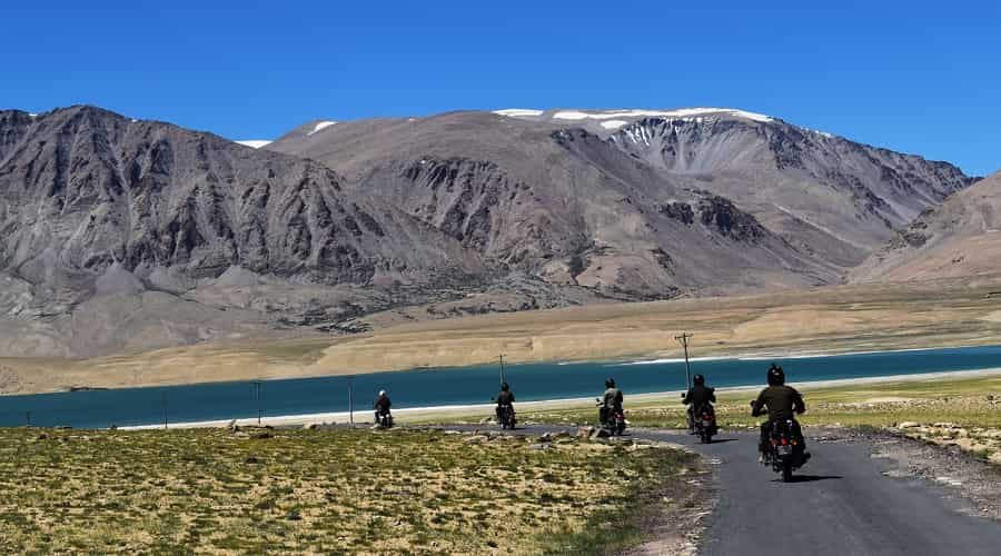
Kashmir Great Lakes Trek
Highlights
- One of most stunning treks to explore 5 high altitude lakes in the World
- Cross high altitude passes and witness snow capped mountain peaks
- Steep ascend with small villages on the trekking trail
- Trekking route passes through meadows, snow filled glaciers, high altitude passes and sparkling streams
Key Facts
- Region : Jammu and Kashmir
- Duration : 8-9 Days
- Difficulty : Moderate
- Highest Altitude: 13,800 ft
- Best Time : July to August
- Trekking Distance: 72 Km
- Average Temperature: 15°C -20°C (Summer) and -3°C – 5°C (Winter)
- Trip Starting Point : Sonmarg
- Nearest Railway Station : Jammu Tawi or Udhampur Railway Station
- Nearest Airport : Srinagar
Strating from Sonmarg, Kashmir Great Lakes Trek takes you to the five high altitude lakes of India. Consist of adventure and thrill; this trek will pass through high altitude passes like Gadsar and Nichinai. You can also enjoy the panoramic views of the great Himalayas covered with snow. A moderate trek offers one of the most magnificent experiences in Kashmir which can’t be forgotten.
Trek Route: Srinagar – Sonamarg – Nichnai (via Shekdur) – Vishansar Lake – Gadsar (via Kishasar and Gadsar Pass) – Satsar – Gangabal Twin Lakes – Naranag – Srinagar
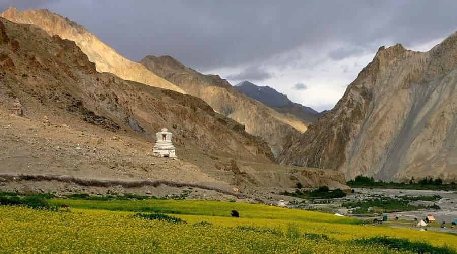
Chadar Trek
Highlights
- Trek on frozen Zanskar River
- Visit Leh Town
- View of Stok Kangri
- Tibb Cave
Key Facts
- Region : Zanskar (Ladakh), Jammu and Kashmir
- Duration : 13 Days
- Difficulty : Challenging
- Altitude: 12,628 ft
- Best Time : Mid January to Mid February
- Trekking Distance: 75 Km
- Average Temperature: (-5)°C –(-10)°C (Day) and (-25)°C – (-35)°C (Winter)
- Trip Starting Point : Sonmarg
- Nearest Railway Station : Jammu Tawi or Udhampur Railway Station
- Nearest Airport : Leh
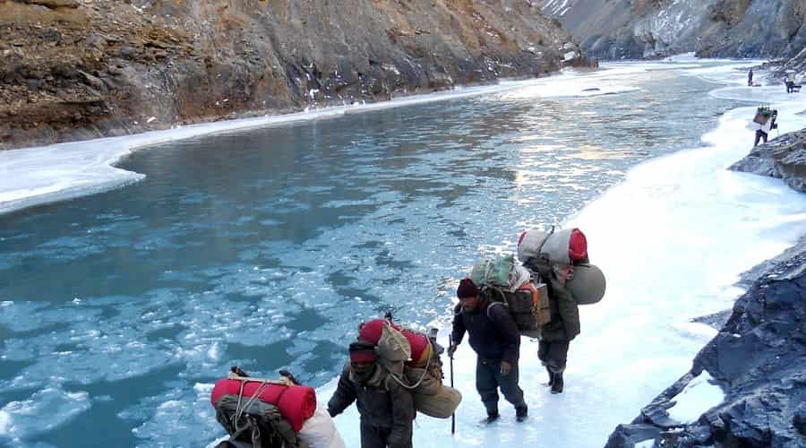
January and February are famous for Winter Chadar Trek. From mid January to mid February many adventure enthusiasts head out to trek in the frozen Zanskar River. It is agreeably one of the most challenging and best treks in World. Chadar trek begins from Chilling passing through Nyarak village, Nyarakpulu and Lingshed and finally ends at Chilling.
Trek Route: Leh – Chilling – Tilad Do – Shingra Koma – Tibb Cave – Naerak – Tibb Cave – Shingra Koma – Tilad Do – Leh
Markha Valley Trek
Highlights
- A tea house which offers trekking in Chilled Cold desert valley
- Panoramic views of Kang Yatse and Stok Kangri Peak
- Crossing through various Buddhist villages and rocky ravines
- Trekking inside Hemis National Park
- Varying landscapes and crossing two high altitude passes – Ganda la and Kongmaru la
Key Facts
- Region : Ladakh, Jammu and Kashmir
- Duration : 7-10 Days
- Difficulty : Moderate
- Altitude: 17,060 ft
- Best Time : July – September
- Trekking Distance: 75 Km
- Trip Starting Point : Spituk
- Trip Ending Point: Leh
- Nearest Railway Station : Jammu Tawi or Udhampur Railway Station
- Nearest Airport : Leh
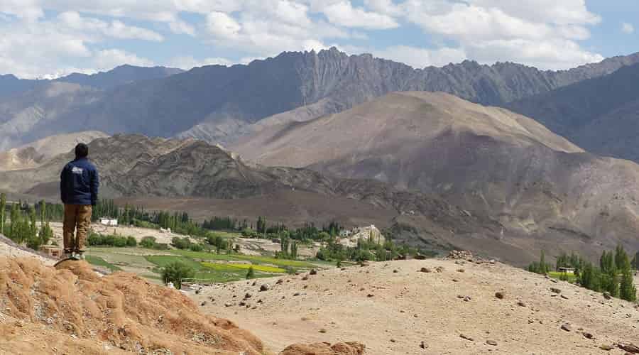
Markha Valley is situated between the Zanskar and Leh region of Ladakh in J&K. This valley is located at a short distance from Leh and offers magnificent, wild and barren terrains. Markha Valley is also called as Little Tibet sometimes. Markha Valley Trek, a tea house trek which offers trekking in the chilling cold desert valley. This trek is famous for its beautiful views of Kang Yatse peak and Stok Kangri peak, Buddhist villages and rocky ravines. The trek happens inside Hemis National Park and includes two pass crossings – Ganda La (15,748 ft) and Kongmaru La (17,060 ft). This trek is famous for its varying landscapes. Deep river crossings are also one of the major attractions of this trek. It is a moderate trek which requires technical skills and physical fitness.
Trek Route: Leh – Spituk – Zinchen – Yurutse (via Rumbak village) – Skiu (via Ganda La) – Markha – Thochuntse – Nimaling – Shang Sumdo (via Kongmaru La) – Hemis – Leh
Stok Kangri Trek
Highlights
- Climbing of Stok Kangri peak
- Panoramic view of Ladakh ranges, Karakoram ranges and Zanskar ranges from the summit
- Visit Buddhist monasteries in Ladakh
- Changing landscapes and cross Markha valley
Key Facts
- Region: Zanskar, Ladakh, Jammu and Kashmir
- Duration : 10-15 Days
- Difficulty : Challenging
- Altitude: 20,177 ft
- Best Time : July – September
- Trekking Distance: 80 Km
- Trip Starting Point : Leh
- Trip Ending Point: Leh
- Nearest Railway Station : Jammu Tawi or Udhampur Railway Station
- Nearest Airport : Leh
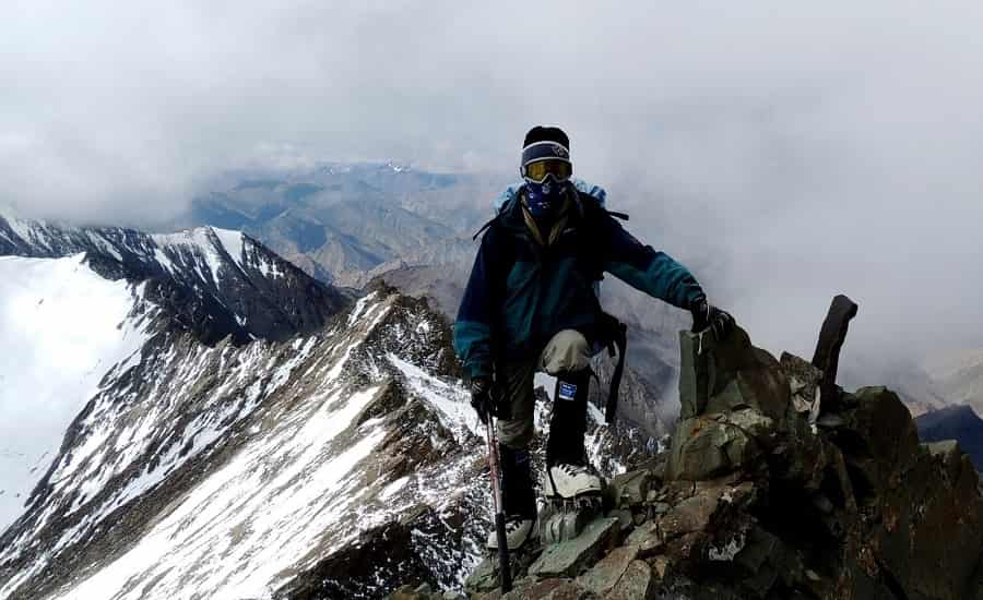
Stok Kangri, the highest mountain peak in the Stok range of the Himalayas, is located south of Leh which can be accessed by trekking to Stok village and further climbing of the peak. This peak is the highest trekkable summit in India and declared by IMF (Indian Mountaineering Foundation) as an open trekking peak.
Stok Kangri Trek is one of the most difficult treks in Ladakh due to the climbing of the peak. This trek requires mountaineering skills if you want to climb the peak. This is the trek for those who are some real adventure freaks. This trek offers you several obstacles, climbing on the steep hills, facing sunny morning to snow storms, and trekking on rambling routes which will ultimately lead you to Stok Kangri Peak. It is one of the arduous treks in Ladakh which requires proper acclimatization before starting the trek to Rumbak village.
Trek Route: Leh – Spituk – Zinchen – Stok La (via Rumba village) – Mankorma – Base Camp – Stok Kangri Summit – Stok village – Leh
Sham Valley Trek
Highlights
- Leh bazaar
- Visit some of the oldest monasteries of Ladakh
- Ang Village, a splendid village with apricot and orchards
- Passes through beautiful villages of Hemis, Tingmosgang, and Shukpachan
- Experience the magnetic power of Magnetic Hill
Key Facts
- Region: Ladakh, Jammu and Kashmir
- Duration : 7 Days
- Difficulty : Easy
- Altitude: 12,303 ft
- Best Time : June – October
- Trekking Distance: 58 Km
- Trip Starting Point : Leh
- Trip Ending Point: Leh
- Nearest Railway Station : Jammu Tawi or Udhampur Railway Station
- Nearest Airport : Leh
An Easy trek which will pass through some of the beautiful monasteries like Lamayuru, Spituk, Likir and Alchi, Also known as “Apricot Valley”, Sham valley is known for its Apricot orchards. Trek starts from Likir and passes through Chagatse La and Phobe La before reaching Leh. Sham Valley is picturesque and a delight for photographers. The best time to visit this trek is from June to mid October when the weather is calm and pleasant. This trek is perfect for families and beginners.
Trek Route: Leh – Shey –Thiksey –Hemis – Likir – Yangthang across Phobe La – Hemis Shukpachan – Ang across Mebtak La – Temisgam – Nurla – Leh
Trans Zanskar Expedition
Highlights
- Visit various Ladakhi villages like Mulbek, Sumdo etc.
- Visit various monasteries of Rangdum, Padum etc
- Trekking on the rugged terrain of Ladakh
- Explore the untouched region of Zanskar
Key Facts
- Region: Zanskar, Jammu and Kashmir
- Duration : 25-27 Days
- Difficulty : Challenging
- Highest Altitude: 17,000 ft
- Best Time : Mid June – September
- Trip Starting Point : Mulbek
- Nearest Railway Station : Jammu Tawi or Udhampur Railway Station
- Nearest Airport : Leh
Situated at an altitude of 3,500 – 7,000 m and one of the least explored regions in India, Zanskar is a semi – arid high altitude desert. Snow capped mountains, barren lands, gleaming Blue River, monasteries, and breathtaking views eventually makes it a perfect destination for travel enthusiasts. Major attractions of remote Zanskar trek are River Zanskar, Zangla, Sumdo and views of twin peaks of Nun and Kun. Trek begins from Mulbek and passes through Rangdum, Padum, Zangla, Sumdo and Markha Valley which finally concludes at Leh.
Trek Route: Leh – Mulbek – Rangdum – Padum – Zangla – Sumdo village – Camp Site – Tilad Sumdo – Base of Rubang La – Markha Valley – Thochuntse – Nimaling – Sumdo – Hemis – Leh
Best Treks in Sikkim
Goecha La Trek
Highlights
- Samiti Lake and the reflection of Mt Pandim in the lake
- Trekking trail passes through rhododendron forests
- Picturesque views of Mt. Kanchenjunga
- Panoramic view of high mountain peaks from Dzongri top
Key Facts
- Region: Sikkim
- Duration : 11 Days
- Difficulty : Moderate – Difficult
- Altitude: 15,110 ft
- Best Time : April – June
- Average Temperature: 13°C -18°C (Daytime) and 3°C – 5°C (Night)
- Trip Starting Point : Yuksom
- Nearest Railway Station : New Jalpaiguri
- Nearest Airport : Bagdogra Airport, Siliguri, West Bengal
One of the famous but least explored treks in comparison to treks from Himachal and Uttarakhand, Goecha La trek is the perfect treat for mountain lovers. Those who want to see the grand views of high mountains, and then this is the trek for them as you can see 14 big summits. Sunrise view of Mt. Kanchenjunga is the major highlight of the Goecha La trek. Trek to Goecha La passes through rhododendron forests. Another major attraction on this trek is Samiti Lake. This trek is perfect for the mesmerizing views of Mt Kanchenjunga and other high Himalayan Peaks.
Trek Route: New Jalpaiguri – Yuksom – Bhakim/Sachen – Tshoka – Dzongri (via Phedang) – Dzongri top – Thansing (via Kockchurang) – Lamuney – View Point One (via Samiti Lake) – Thansing – Tshoka – Yuksom – New Jalpaiguri
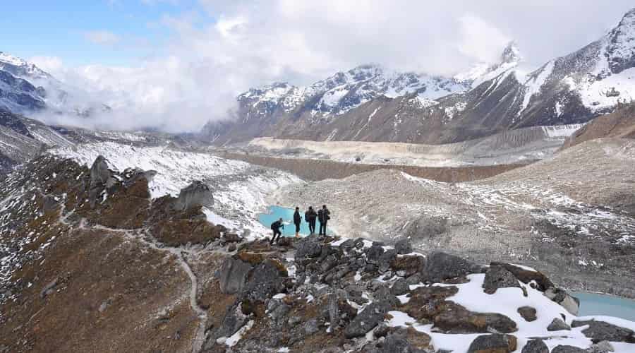
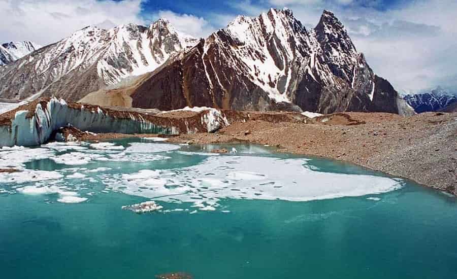
Mt. Kanchenjunga Base Camp Trek
Highlights
- Spectacular views of Mount Kanchenjunga, 3rd highest mountain peak in the world
- Picturesque trekking trail
- Diverse landscapes from forests to meadows
- Various other snow-capped mountains
Key Facts
- Region: Sikkim
- Duration : 11 Days
- Difficulty : Moderate
- Altitude: 17,060 ft
- Trekking Distance : 90 Km
- Best Time : Mid March – Mid June and Mid September to November
- Average Temperature: 13°C -18°C (Daytime) and 3°C – 5°C (Night)
- Trip Starting Point : Yuksom
- Nearest Railway Station : New Jalpaiguri
- Nearest Airport : Bagdogra Airport, Siliguri, West Bengal
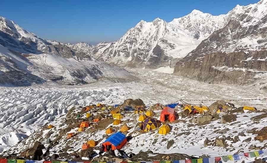
This trek will take you to the camp of the third highest peak in the world, Mount Kanchenjunga. Mount Kanchenjunga is located on the border of India and Nepal which is the second highest mountain peak of the Great Himalayas. This trek passes through tribal villages, remote valleys, high altitude passes and frozen lakes. This trek starts from Yuksom and from there you can experience the mesmerizing views of serene villages, snow capped mountains, dense forests and changing landscapes.
During this trek you will witness the breathtaking views of Mt. Kanchenjunga, Mt Pandim, Mt Kokthang, Kabru Peak, Frey Peak and other Himalayan peaks.
Trek Route: Yuksom – Tshoka – Dzongri – Bukhari – Chaurikhang – Rathong Glacier (Kanchenjunga Base Camp) – Bukhari – Bakkhim – Yuksom
Green Lake Trek
Highlights
- Tashi view Point and Phodong monastery
- Trek into rhododendron forests
- Trek to the Green Lake
- Breathtaking view of Mt Kanchenjunga and other Himalayan peaks
- Camp near the green lake
Key Facts
- Region: Sikkim
- Duration : 16 Days
- Difficulty : Challenging
- Altitude: 16,186 ft
- Trekking Distance : 92 Km
- Best Time : April – October
- Average Temperature: 13°C -18°C (Daytime) and 3°C – 5°C (Night)
- Trip Starting Point : Lachen
- Nearest Railway Station : New Jalpaiguri
- Nearest Airport : Bagdogra Airport, Siliguri, West Bengal
Green lake is located at the base of Mt Kanchenjunga in the state of Sikkim in India. This lake trek can be done from Lachen by an arduous and picturesque trek. Like other treks in Sikkim, this trek is also less explored by trekkers. This trek will take you to the base of Kanchenjunga. From there you can witness the breathtaking views of Kanchenjunga Central, Yalung Kang, Kangbachen, and Kanchenjunga South. This trek is tricky which passes through some of the remote tribal villages situated at high mountains. Trek also passes through rhododendron forest, alpine trees and flowering plants.
Trek Route: Gangtok – Lachen – Tallem – Jakthang – Yabuk – Rest Camp – Green Lake – Rest camp – Yabuk – Jakthang – Tallem – Lachen – Gangtok