About Parvati Valley
Pin Parvati Trek goes through multiple beautiful destinations that are once in a lifetime experience. There are dazzling views of the Spiti valley, of the Mantalai Lake and Parvati valley as well as the Pin glacier. The entire Pin Parvati Pass trek is adventure packed and for sure is bound to be a unique experience in each of the trekker’s life. It takes an utmost passion for one to complete the trek despite the difficulties one face and all the difficulties are worth facing as the experience is spellbound.
About the Pin Parvati Trek
One of the best trek you will ever experience it is spanned over 11 days. Starting at Kaza and ending at Barsheni, each day of this trekking is action-packed. The landscapes change a lot and so does the experience. IT is easy certain days, while on certain others it becomes too difficult.
Trek Highlights
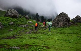
Pin Parvati is suitable trekking site for an experienced trekker who is looking for more adventure. It is not just about the beautiful roads or about the places you go to but it is also a survival lesson, an achievement in itself. Travelling for 110-kilometers to a high of 17,500 feet is not an easy task. It covers forests and meadows of Parvati valley to the Buddhist villages of Spiti valley. It goes through a rote which doesn’t have settlements and is secluded, out of human intervention making you see the most beautiful sights in your life.
There is a pulley bridge at Tunda Bhuj to swamplands of Mantalai to mountainous pastures of Odi Thach, dense forests near Kheerganga and glacier near the Pass. Near the end of the Pin Parvati trek, you also can go for the hot water springs at Parvati Kund at Kheerganga. Here is where you experience heaven, a hot water bath after 6 days of continuous trekking.
Key Facts About Trek
- Location: Himachal Pradesh
- Starting from: Manali
- Temperature: 5 to 10degree Celsius in the morning; 2 to 5 degree Celsius at night
- Trekking Distance: 110-kilometers
- Maximum altitude: 17,500 feet
- Difficulty Level: Moderate
- Nearest Railway Station: Joginder Nagar Railway Station
- Nearest Airport: Bhuntar Airport, Kullu
- Accommodation Type: Camping
- Food: Nutritious food suitable for trekking
- Best time to visit: Mid-June to September
- Duration: 11 Days and 10 Nights
- Key attractions: Spiti river, Parvati Valley, Pin Glacier, Mudh Village, Kheerganga, Mantalai Lake, Odi Thach
Tour Itinerary
Day- 1: Ride to the base camp at Kaza
From Manali, a pick up would be arranged at 6 in the morning. The travel would be through Rohtang pass and Kunzum pass which is known for its traffic block making it mandatory to leave Manali by 6 am. From Gramphu, take a deviation towards the Gramphu – Batal – Kaza road. From Batal the road enters the beautiful Spiti valley. There are old and small settlements, pea and barley fields and the route looks like a film scene. The campsite is on the banks of Spiti River at Kaza. This is the day when the process of acclimatization starts.
Day- 2: Acclimatization day at Kaza
A complete day is left out for the traveler to feel adjusted to the weather conditions around and sort out altitude sickness if any at Kaza.
Day- 3: Drive from Kaza to Mudh village; trekking from Mudh to Tiya
From Kaza, after taking ample rest one would be driven down to another village at a lower altitude called the Mudh village. The 2-hour drive covers around 49-kilometers. From Mudh village proper trekking begins to Tiya, which is a two to the three-hour-long route. Mudha is a beautiful village. There are many guest houses in here. One you leave Mudh you will see a settlement next on the second last day at Kheerganga. The Pin Parvati trek is also proper as the routes are well demarcated. You will be descending the river bed to set a camp at Tiya.
Day- 4: Trekking from Tiya to Shia
This is one of the beautiful routes of the entire trekking. The route is filled with glacial streams and scenic views of the Spiti valley. Freshwater could be taken from the glacier. You will have to cross the Pin River as you move ahead. Walking further through the tricky road you can see the Pin glacier uphill. Shia is a rocky area and you’ll have to set up camps in between the available space. The area is prone to a landslide so be careful.
Day- 5: Shia to Pin Base Camp
The day begins with one crossing the Pin River. The river could be crossed barefoot but the stones and pebbles on the riverbed is an issue. The flow could be quite strong, hence one might have to climb 2km ahead and cross it over the glacier.
The uphill trek to Pin Parvati pass base camp is quite steep, with an ascent of 1700 feet. This can leave you breathless. As you ascent ahead comes to a stream which you will have to cross. The stream originates from the Pin glacier. One has to take special care to cross it. Pin base camp is rocky and dry. It is located below the pin glacier and some 1000 feet below the pass. It is windy and makes you feel dry.
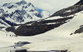
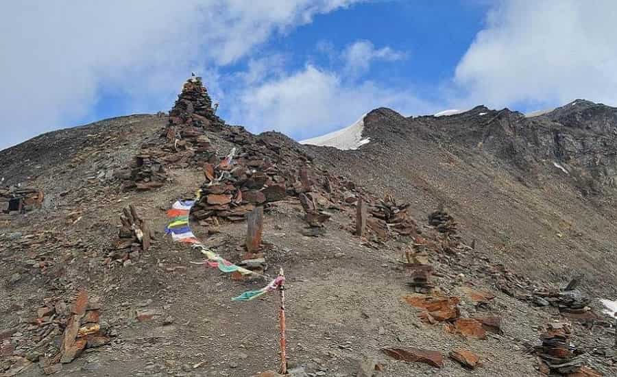
Day- 6: Pin Base camp to Mantalai via Pin Parvati Pass
It is always advisable to start the Pin Parvati trek from here early as crossing the path is crucial. Afternoon, there is no scope of travel. The uphill trek is very hard due to the altitude. From the Pin Parvati Pass one can watch both Pin valley and Parvati valley.
The downhill trek to Parvati glacier is highly difficult. The steep is sharp. The snow hides the clefts. IT is better to take the guidance of your lead while going through this place. Parvati Base Camp is comparable to Pin Base Camp.
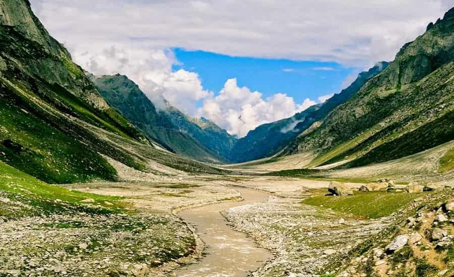
Descend to Mantalai is steep as well. But this gives spectacular views of the Parvati valley, making all the effort worthwhile. It is in the trekking till now, the loveliest and unique campsite you have come across on this trek.
Day- 7: Rest day at Mantalai Lake
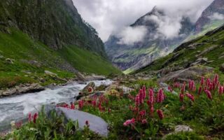
A trekking for 9km downhill would take you to Odi Thach, one of the prettiest meadows that you will ever come across. Walking ahead and crossing some boulders takes you to Mantalai. After crossing the first of the series of elevations, you officially depart the Mantalai region. The wildflowers in Odi Thach are of red, blue and purple colors that makes the entire meadow colorful. There is also a swamp land in here. However, the campsite is at a place called Jwari Thach which is another beautiful meadow of the Spiti valley.
Day- 8: Trek from Odi Thach to Tunda Bhuj
This is a difficult trekking route. Parvati river would be flowing left of the trekking route. There is also a spectacular view of Mt Kullu Eiger in your front. Glaciers are also visible. From here you go downhill to Pandu Pul, a natural bridge formed by small stones over the years. This can turn out to be slippery especially if it is raining. Then you enter a patch of forest which has a quite tricky route. Once done with it you will be entering the forest area, carpeted with rhododendrons and pine trees. The greenery feels like luminescent. Tunda Bhuj campsite is a bowl on the mountain enclosed by cliff faces, higher up from the river.
Day- 9: Trek from Tunda Bhuj to Kheerganga
Trek to Kheerganga is a descent to the valley below Parvati River. There are many scenic waterfalls along the way, so are pasture lands with birch trees. The first forest section of the descend is a pine forest. This could be a bit adventurous as the muddy land can be slippery. This opens to the pastures, which is full of bushes and boulders. The shepherd tents could be found around who will provide you with fresh buffalo milk. Then you will have to walk ahead to cross the second bridge, walking 25 minutes further one would reach the settlements. Kheerganga has many Dhabas. Kheerganga is the last campsite as the next day you’ll descend towards the end of the trekking at Barshaini. Kheerganga is famous for its cafes and hot springs. People are permitted to take bath in these hot water springs.
Day- 10: Trek from Kheerganga to Barshaini, departing from Barshaini
Hiking for around 7km from Kheerganga one would reach Barshaini, where the Trek ends. Transportation is provided from Barshaini to Kullu. The trek from Kheerganga is through thick forests. The ascent is steep and slippery, hence lot of care shall be taken. You can find many food stalls along the way and there are freshwater streams as well. As you walk further you will reach a bridge that runs on top of Parvati. Walking five more minutes ahead you would reach Rudranag – a sacred place dedicated to Lord Shiva. This also has a waterfall in its premises.
Then walking further you enter Nakthan village which has a meadow with apple orchards called the Swargani maidan. From here the road is motorable, however, one can choose to trek rill Barshaini which is 12-kilometers ahead. If one opts for trekking he or she will have to go through Pulga, Uchich village and to Barshaini.