Maharashtra is one of the Indian states located on the western side of the Deccan Plateau and is endowed with prosperous topography and geography. The mighty Arabian Sea embraces the west borders with beautiful Beaches and a shoreline of 750miles.The Ghats are embraced with bushy forests. There are many rivers in this mystic land but the major ones are Godavari, Tapi, Narmada and Krishna that flows through Maharashtra. Godavari is one of the important rivers with Manjira, Purna, Penganga and Wardha being the primary tributaries. River Krishna has its origin in the Ghats of Mahabaleshwar flowing through 3 states of Karnataka, Andhra Pradesh and Maharashtra. Small rivers have nowadays become sewage drains due to the growth of heavy industrialization.
There are numerous number of lakes in Maharashtra like Ambazari Lake, Koyna Lake, Lonar Lake, Ramkund Lake etc. Mulshi Lake close to Lonavala, Lake Venna in Mahabaleshwar are some of the famous lakes. There are dozens of lakes in Thane and is popularly called as the lake City and has around thirty reservoirs. Some of the important lakes in this city include:
The Talao Pali Lake, Upvan Lake. These lakes attract hoards of visitors and are quite popular as recreational joints where visitors venture often for expeditions on holidays and weekends.
Ambazari Lake
Facts:
- Situated: 6km west of Nagpur, (Maharashtra)
- Famed as: Picnic spot
- Other Attractions: Mini train, Boating, Animal kingdom, Musical fountain.
The Ambazari Lake is situated on the west side of Nagpur; it is the biggest and the most attractive lake in the city of Nagpur.
The Ambazari Garden:
This garden is really very beautiful. It is thronged alongside the lake .The scenic atmosphere is really enthralling. This garden was developed by the Nagpur Municipal Corporation in the year 1958.The total area of this garden is 20 acres. There is a musical fountain, which dances to the beat of the Music and also with different effects of lightings. The tiny tots will enjoy the view here.
A Delighting Air Show:
The aero modeling show, which is shown every Saturday and Sunday, attracts thousands of visitors .This show is held every evening, in which seaplanes are shown to land on the water. The population of the visitors is usually three –four thousand daily except on weekends when it is ten –fifteen thousand.
The Ambazari Lake is an apt place for outings, one can also enjoy boating, and this service is rendered by Rajkamal Water sports Centre.
How to Reach There?
Nagpur is a well-versed city linked by rail, road and air. Taxis, auto rickshaws and city buses are available for local Transport.
Accommodation:
Hotels suiting all types are available.
Krishna River
Krishna River arises in the Western Ghats at a level of 1337m in the north side of Mahabaleshwar. Krishna River is just 64-km away from the Arabian Sea and runs for about 1400-km and exits into the Bay of Bengal. The important tributaries of this river are the Malaprabha, the Tungabhadra, the Music and the Ghataprabha.
Krishna Basin covers an area of 258,948km that is approximately 8% of the total land of the country. The river basin lies down in the state of Maharashtra-69,425km, Karnataka-113,271km, Andhra Pradesh-76,252 km. It has a structural area of 25.9 m.ha.
Almost all the parts of this basin consist of undulating and rolling plains. Only the western border is formed by an unplowed range of Western Ghats .The main types of soil found here are mixed soil, laterite soil, black soils, red soils, lateritic soils, alluvium soils, alkaline soils and saline soils.
The approximate yearly water potential of this river is 78.1 km and from which 58.0km of water can be used. Cultivable area in the basin is 20.3million ha and this is about 10.4%of the total cultivable area of the country. The current use of the water of River Krishna is 50.0km.
The storage capacity of the river has increased from 3.2 km, which was during pre-independence and it has increased to 34.5 km now .There are various ongoing projects under construction after which rise up of 4.9km can be seen .The potential of hydropower generating of this river is 2997MW (60%) load factor.
Pashan Lake
Facts:
- Situated: Pune, (Maharashtra)
- Known For: (Bird Sanctuary)
This lake is situated twelve kilometers away from the famous National Defense Academy (NDA) in Pune; this lake is best known for a migratory bird especially during the winter. Pashan Lake is the bird watchers delight. It is a very famous bird sanctuary.
Pashan Lake has been the source of drinking water for the Governors house now which is called as Raj Bhavan and also to the residents of the Sutarwadi and Pashan area.
This lake spurns over an 110acres of area out of which 60 acres has been nurtured towards tree plantation .This programme is taken by the Pune Municipal Corporation. The only thing which is missing here is the shade.
Although the beautiful lake clinges migratory and resident birds but the environmentalists are concerned about the over forming of slit in the water which is making it stagnant. This condition is troubling the habitat of these birds. The deepness of this lake was 50 feet at one point of time but now it’s just 20 feet due to the slit process.
How to Reach:
Pune is well versed city connected with all the major states via rail, road and air. Autos , city buses and taxis are easily available for local transport.
Godavari River
Godavari River arises near Nasik, which is in Maharashtra at a level of 1067m and runs for a length of 1,465km before falling into the Bay of Bengal. The Manjra, the Wardha, the Penganga, the Parvara, the Kolab, the Indravati and The Purna are the major tributaries of this river.
Godavari River covers an area of 312,812 km, which is almost 9.5% of the entire area of the countries land cover. The river basin lies down in the states of (Andhra Pradesh)-73,201km, (Orissa)-17,752km, (Maharashtra)-152,199km, (Karnataka)-4,405km, (Madhya Pradesh)-65,255km.
Godavari has a structural area of 31.3m.ha.The Godavari river basin comprises of large rolling plains separated by a low flat top hill ranges. The most important types of soils found are lateritic soil, red soils, alluvium soils, black soil, alkaline soils, saline soils and mixed soils.
An approximate yearly water potential of this river is 110.5 km out of which 76.3 km of water is usable. The total fertile area in the basin is 18.9 million ha, and this is 9.7% total fertile land of the country.
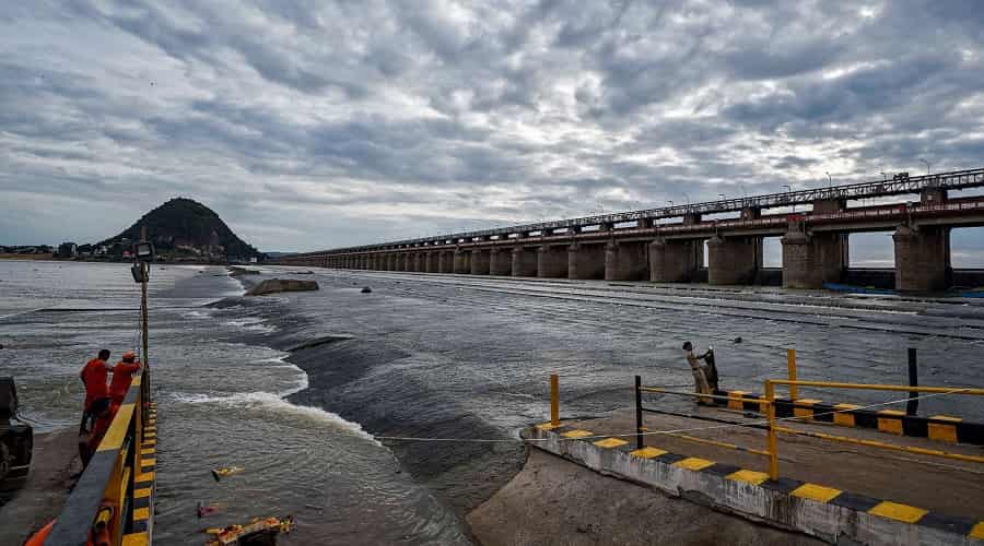
The current use of the water of River Godavari is 41.0-km.The storage capacity of this river has increased from 1.6km to 19.5km.Vishnupuri Prakalp which is the Asia’s largest lift irrigation is built on this river just 5km from the city of Nanded. The potential of hydropower generation of this river is assessed as 5091MW.
Lakes in Thane
Facts:
- Number of lakes present in the city: twenty-three lakes
- Well known Lakes: Upvan Lake, Talao Pali Lake
Thane is known as the Lake City. The major attraction includes Upvan Lake and Talao Pali lake .Gifted with 23 attractive lakes, this city has attracted hordes of buyers for properties.
Talao Pali Lake:
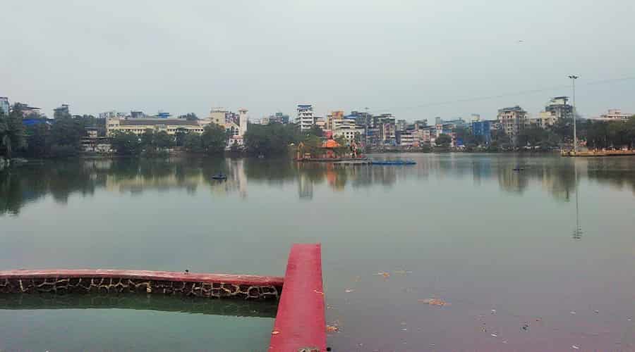
This lake was previously termed as Masunda Talao .This Lake is frequently visited by different generations and this an apt place to indulge in eating, as there are various options available ranging from Bhelpuri to ice cream .There are many restaurants nearby .One can enjoy strolling on the lake side and enjoy the fresh air blowing.
Upvan Lake :
This lake is famous amongst the couples. As there is a park and one could also sit on the small sitting area facing the lake .There are also many Lakeside restaurants where one can spend quality time enjoying the delicious food.
There are other lakes like Ghosale Talao, Siddheshwar Talao, Rewale Talao, Hariyali Talao, Upvan Talo, Khidkaleshwar Talao, Railadevi Talao, Nar Talao, Kasar Vadawali, Bramhala Talao, Kausa Talao, Makhmali Talao and Kachrali Lake.
Accommodations:
There are various hotels one can choose from.
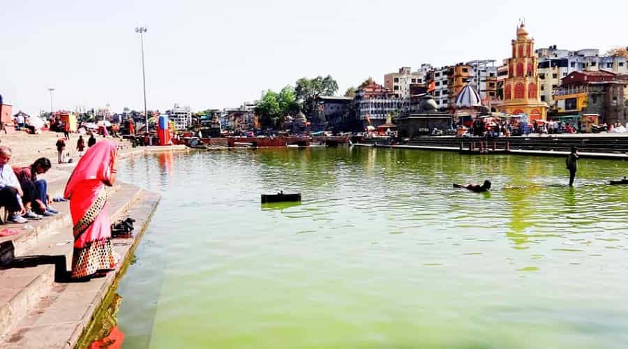
Ramkund Lake
Facts:
- Situated: Panchavati (Nasik)
- Mythological significance: it is said that Lord Rama and Sita used to bathe in this lake when they were in exile
This lake is located in Panchavati a major tourist destination for the mythological significance .As the name suggests Ram Kund means the place where Lord Rama and Sita used to bathe .A dip in this holy lake is considered to be very heavenly. This is the place where every Hindu wishes his or her last rites to take place as it is believed that one attains Moksha or dismissal of the soul.
This lake was built by Chitrarao Khatarkar in 1690AD.The length of this lake is (27m) by (12m).One can visit Gandhi lake which is situated nearby .There is a monument of Gandhi, the Father of The Nation which is made up of white marble .The ashes of Jawaharlal Nehru, YB Chavan, Indira Gandhi and Gandhiji to name a few has been immersed here at Ramkund.
Accommodations:
Many good hotels are available within the budget.
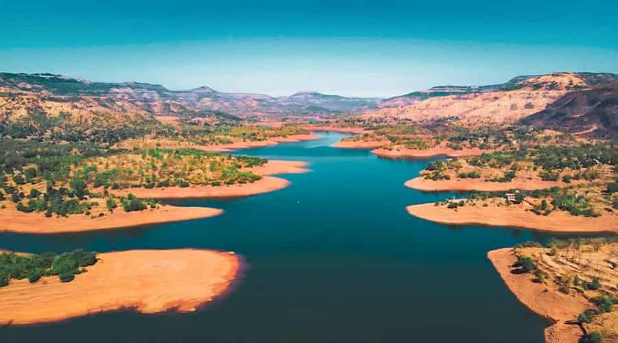
Koyna Reservoir (Dam)
Facts:
- Situated: 60km away from Kolhapur, (Maharashtra)
- Capacity: 2780*106 m3
- Height of the Dam : (103m)
- Levels: (30-35m)
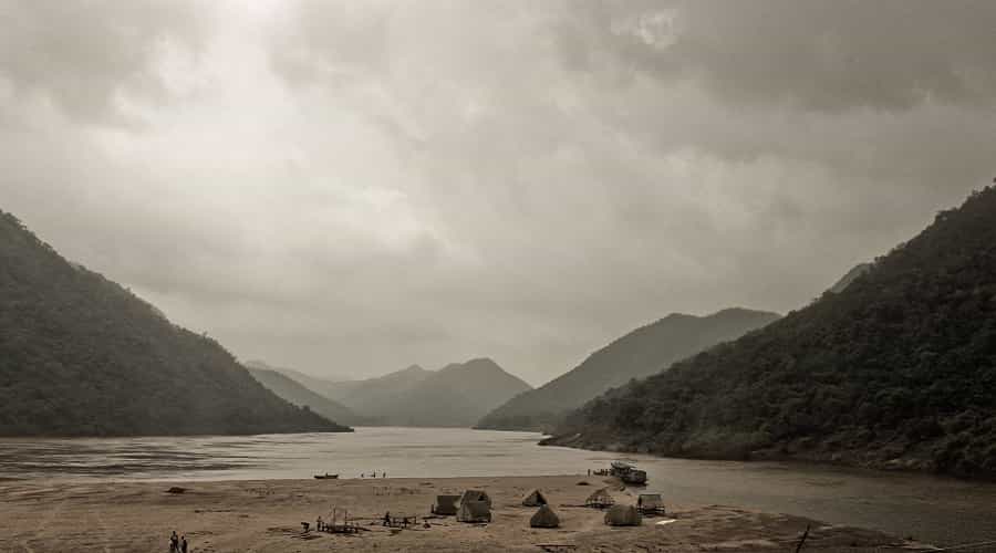
The Koyna region comprises of The Koyna Lake, Mahabaleshwar and Satara. This region is known for its chain from (Mahabaleshwar – Jungli) which is located in the western side of the Koyna Lake. This place is not much visited .One can come across many unknown trails, and passes. This could be a challenge to the trekkers. If one wants to enjoy a boat ride to the Forts, which is located on the western side, you can always approach ferries, which is always on the Koyna Lake .This place is a nature lovers paradise as there are many untouched trails waiting to be discovered so now all the trekkers know where to head.
The Koyna wildlife sanctuary is a famous sanctuary located here. This sanctuary includes the western and eastern catchment areas of the Koyna dam .Koyna dam is also an important project centre of Hydro electricity in the western part of Maharashtra.
The Koyna Dam stimulates high rate of seismicity in the whole world. This dam was impounded in the year 1962.This has resulted in an earthquake in the year 1967, which had recorded 6.3magnitude on the Richter scale and had overpowered over 200 live. Till date more than 150 earthquakes of 4.0magnitude been recorded. The study of reservoir induced or triggered seismicity is famous worldwide. The height of this dam is 103m.The height fluctuates depending on the rainfall.
Accommodation:
Hotels accordingly available for accommodation.
Tapi River
Tapi stretches over an area of 65,145km; this is nearly 2.0% of the total geographical arena of the county. The basin lies down in the states of Gujarat-3,837km, Madhya Pradesh-9,804km, Maharashtra-51,504km.
Tapi River arises close to Multai, which is in Betul district (Madhya Pradesh).The average height of this river is 752m and runs for 724km before falling into The Arabian Sea via the Gulf of Canbay. The main tributaries of this river are the Panjhra, the Bori, the Girna, the Aner and the Vaghur.
The basin comprises of plain areas, which are fertile and broad and this type of land is apt for cultivation .The primary type of soils found here are alluvial soils and Black soils.
An average yearly water potential in this basin is 18.3km out of which 14.5km of water is optimum for use. The total cultivable area is 4.3Million ha and this is 2.2%total fertile area of the country.
The current use of the water of Tapi River is 4.5km.The storage capacity of this River has increased consistently from 0.05%km, which was during the independence to 8.5%.The storage capacity would increase, as the constructions of few projects would get over in some time to 1.0km.The hydropower capacity of this river is 119.7 MW with (60%) load factor.
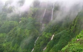
- Also Read: Popular Waterfalls in Maharashtra