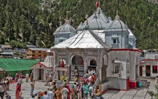
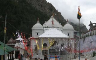
Gangotri is a small place in the Uttarkashi district of Uttarakhand. It is a major pilgrim town and it stands on the banks of the Bhagirathi River that is the origin of Ganges. Gangotri is situated on the Greater Himalaya Range at the altitude of 10,220 feet. Gangotri is one of the 4 holy Chota Char Dhams that is known to be integral to Hindu religion. The original temple was built by Amar Singh Thapa who was the Gurkha general and the river is known as Bhagirathi in the source and Ganga from onwards Devprayag. The Gangotri Glacier is a major pilgrimage spot and it is 19 m away from Gangotri. To know about the various route map options to Gangotri, read on.
How to Reach Gangotri by Road
Gangotri enjoys great road connectivity to major Indian Cities of Uttar Pradesh, Uttarakhand, NCR and Delhi. It is 472 km away from Delhi and 244 km away from Rishikesh. Gangotri enjoys good connectivity the following cities; Roorkee, Kotdwar, Haridwar, Rishikesh, Chamba, Barkot, Dehradun, Janki Chatti and Hanuman Chatti.
Bus services are operated by Samyukt Rotation Yatayat Vyavastha Samiti and this service links Gangotri with many centers in the zone like Uttarkashi, Haridwar, Tehri etc.
Gangotri Route Map from Delhi
The route map options to Gangotri by road are as follows-
Route A via Haridwar
Delhi to Rishikesh (230 km) – Narendra Nagar (21km) – Tehri (60km) – Dharasu Bend (126km) – Uttarkashi (24km) – Bhatwari (32km) – Gangnani (16km) – Harsil (27km) – Gangotri (25km).
Route B via Dehradun
Delhi to Dehradun to Mussoorie to Chamba to Tehri to Dharasu Road to Uttarkashi to Bhatwari to Gangnani to Harsil to Gangotri.
Gangotri Distance Chart (Various Places of Uttarakhand)
- Uttarkashi to Gangotri- 97 Km
- Tehri to Gangotri- 167 km
- Dharasu to Gangotri- 120 km
- Yamunotri to Gangotri- 232 Km
- Mussoorie to Gangotri- 251 km
- Rishikesh to Gangotri- 244 km
- Delhi NCR to Gangotri- 450 km
- Dehradun to Gangotri- 310 km
Gangotri Temple Distance from Famous City of India |
|||
| Pune – 1950km | Nagpur – 1490km | Mumbai – 1908km | Hyderabad – 2000km |
| Chennai – 2648 km | Bangalore – 2606km | Kochi – 3133km | Kolkata – 1820km |
| Jaipur – 780km | Surat – 1616km | Rajkot – 1621km | Vadodara – 1468km |
| Ahmedabad – 1450km | Vijayavada – 2291km | Guwahati – 2108km | Bhubaneswar – 2080km |
| Patna – 1300km | Bhopal – 1210km | Gwalior – 774km | Indore – 1340km |
| Lucknow – 768km | Haldwani – 490km | Noida – 472km | Gurgaon – 504km |
| Amritsar – 588km | Kota – 1026km | Kanpur – 801km | Ambala – 350km |
Trekking Route to Gangotri
The trekking route map for Gangotri Gaumukh Tapovan is as follows
Delhi to Haridwar to Rishikesh to Uttarkashi to Gangotri to bhojbasa to Gomukh to Tapovan to bhojbasa to Gangotri.
Gangotri by Air
The nearest airport from Gangotri is the Jolly Grant Airport which it is only 15 km away from Rishikesh and many tourists take a taxi or Luxury bus to reach Gangotri.
Gangotri by Train
The nearest railway station to Gangotri is Rishikesh (244 km) away and thereafter a cab or bus has to be taken to reach Rishikesh. Very few trains connect Rishikesh and Kotdwar to major cities. Haridwar railway station on the other hand enjoys excellent connectivity to major cities like Mumbai, Howrah, Delhi, Amritsar, Ahmadabad etc.