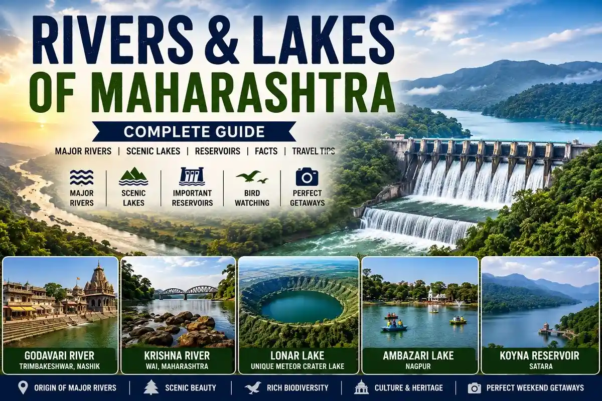
Maharashtra’s rivers and lakes are a big part of what makes the state’s geography so varied, from the Western Ghats down to the Arabian Sea coastline. Maharashtra sits on the western side of the Deccan Plateau, bordered by roughly 720 km of Arabian Sea coastline along the Konkan region, backed by the forested slopes of the Sahyadri range.
Several major Indian rivers, including the Godavari and Krishna, originate in this state, while its lakes and reservoirs range from tranquil city waterbodies to one of the world’s few meteor-crater lakes. This updated 2026 guide covers Maharashtra’s most notable rivers and lakes, with corrected facts, current place names, and answers to common questions.
At a Glance
- Major rivers: Godavari, Krishna, Tapi, plus tributaries like Bhima, Wardha, Wainganga, and Ulhas
- Major lakes and reservoirs: Lonar Lake, Ambazari Lake, Pashan Lake, Ramkund (sacred kund), Koyna Reservoir, Mulshi Reservoir
- Best for families: Ambazari Lake, Venna Lake
- Best for birdwatching: Pashan Lake
- Best for a monsoon weekend trip: Mulshi Reservoir, Koyna Reservoir
- Best for pilgrimage and history: Ramkund, Nashik
Quick Facts: Rivers and Lakes in Maharashtra
| Category | Details |
| Coastline | About 720 km along the Arabian Sea (Konkan coast) |
| Major Rivers | Godavari, Krishna, Tapi, and their tributaries |
| Major Lakes/Reservoirs | Lonar Lake, Ambazari Lake, Pashan Lake, Ramkund (sacred kund), Koyna Reservoir, Mulshi Reservoir |
| Lake City | Thane, with around two dozen lakes including Talao Pali and Upvan Lake |
| Unique Feature | Lonar Lake, one of the world’s few basaltic meteorite-impact crater lakes |
Major Rivers of Maharashtra
Godavari, Krishna, and Tapi are the three major rivers that originate in or flow through Maharashtra, along with important tributaries like the Manjira, Purna, Penganga, and Wardha. Smaller rivers closer to major cities have increasingly suffered from pollution and industrial waste over the decades, a growing environmental concern across the state.
Godavari River
Quick Facts
- Location: Originates near Trimbakeshwar, close to Nashik, Maharashtra
- Length: About 1,465 km, flowing into the Bay of Bengal
- States Covered: Maharashtra, Telangana, Andhra Pradesh, Chhattisgarh, Odisha, Madhya Pradesh, Karnataka
- Best Time to Visit: October to March, for pleasant weather along the ghats
- Suggested Duration: 1–2 hours for the Trimbakeshwar/Nashik ghats; longer if combined with temple visits
- Sightseeing: Trimbakeshwar Temple, Nashik’s riverside ghats, Vishnupuri Prakalp irrigation project
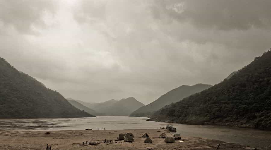
The Godavari River rises near Trimbakeshwar, close to Nashik in Maharashtra, at an elevation of about 1,067 metres, and runs for roughly 1,465 km before emptying into the Bay of Bengal. Its major tributaries include the Manjira, Wardha, Penganga, Pravara, Kolab, Indravati, and Purna.
The Godavari basin covers about 312,812 sq km, nearly 10% of India’s total land area, and today spans seven states: Maharashtra (roughly 48.6% of the basin), Telangana (about 19%), Andhra Pradesh, Chhattisgarh, Odisha, Madhya Pradesh, and Karnataka. Vishnupuri Prakalp, one of Asia’s largest lift irrigation projects, is built on the river just 5 km from Nanded. Beyond hydropower (assessed at around 5,091 MW), the river is a lifeline for irrigation and drinking water across the Deccan Plateau.
Krishna River
Quick Facts
- Location: Originates in the Western Ghats near Mahabaleshwar, Maharashtra
- Length: About 1,400 km, flowing into the Bay of Bengal
- States Covered: Maharashtra, Karnataka, Telangana, Andhra Pradesh
- Best Time to Visit: October to February, especially around Mahabaleshwar and Wai
- Suggested Duration: 1–2 hours at the Wai ghats; a half-day if combined with Mahabaleshwar viewpoints
- Sightseeing: Mahabaleshwar viewpoints, Wai’s riverside temples and ghats, the Panchganga confluence at Sangli
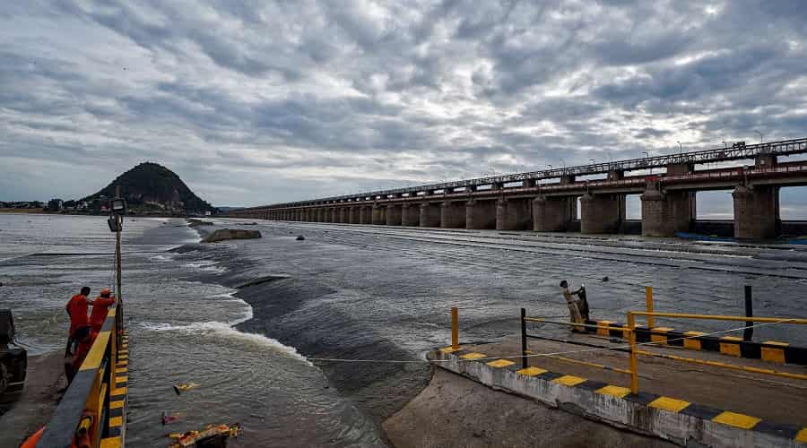
Krishna River rises in the Western Ghats at an elevation of about 1,337 metres, just north of Mahabaleshwar, and is only around 64 km from the Arabian Sea at its source despite eventually flowing roughly 1,400 km east to the Bay of Bengal. Its major tributaries include the Malaprabha, Tungabhadra, Musi, and Ghataprabha.
The Krishna basin covers about 258,948 sq km, close to 8% of India’s total land area, and lies across four states: Karnataka (113,271 sq km), Maharashtra (69,425 sq km), and Telangana and Andhra Pradesh, which together account for the remaining share once counted as undivided Andhra Pradesh before the 2014 state reorganisation. Its storage capacity has grown from about 3.2 cubic km before independence to roughly 34.5 cubic km today, supporting irrigation, drinking water, and hydropower (about 2,997 MW) for millions of people across four states.
Tapi River
Quick Facts
- Location: Originates near Multai, Betul district, Madhya Pradesh
- Length: About 724 km, flowing into the Arabian Sea via the Gulf of Khambhat
- States Covered: Madhya Pradesh, Maharashtra, Gujarat
- Best Time to Visit: October to February for cooler, drier weather along the river
- Suggested Duration: 1–2 hours for a riverfront visit in Surat or a Maharashtra town along its course
- Sightseeing: Surat’s riverfront, the Gulf of Khambhat estuary
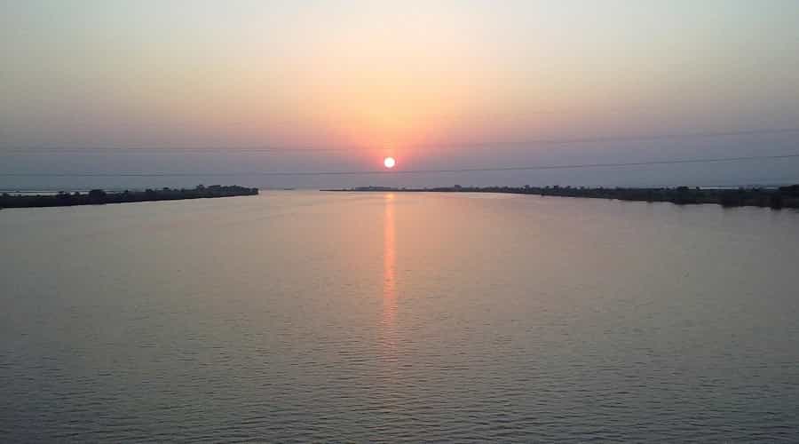
Tapi River rises close to Multai in the Betul district of Madhya Pradesh, at an average elevation of about 752 metres, and runs for roughly 724 km before draining into the Arabian Sea via the Gulf of Khambhat. Its main tributaries are the Panjhra, Bori, Girna, Aner, and Vaghur.
The Tapi basin spans about 65,145 sq km, roughly 2% of India’s geographical area, across Gujarat, Madhya Pradesh, and Maharashtra, with Maharashtra accounting for the largest share at 51,504 sq km. Its storage capacity has grown from a fraction of a percent at independence to about 8.5%, and it remains an important source of irrigation and hydropower (roughly 119.7 MW) for the Khandesh region of Maharashtra.
Other Notable Rivers of Maharashtra
Beyond the Godavari, Krishna, and Tapi, several tributaries and smaller rivers are locally significant across Maharashtra.
| River | Known For |
| Bhima | Major Krishna tributary; originates near Bhimashankar, feeds the Ujjani Dam |
| Wardha – Wainganga | Vidarbha’s key river system; forms part of the Pranhita, a major Godavari tributary |
| Penganga | Tributary of the Wardha, flowing through Vidarbha and Marathwada |
| Purna | Godavari tributary flowing through the Purna Valley near Nanded |
| Manjira | Godavari tributary rising in Maharashtra, flowing through Telangana |
| Mula-Mutha | Pune’s twin rivers, formed by the confluence of the Mula and Mutha near the city |
| Ulhas | Key river of the Kalyan-Thane region, flowing into the Arabian Sea near Vasai |
| Savitri | Konkan river known for the Savitri river bridge tragedy and Mahad’s Panchad waterfalls |
| Kundalika | Popular Konkan river near Kolad for white-water rafting |
| Vaitarna | Feeds major Mumbai water-supply reservoirs, including Upper Vaitarna Dam |
Major Lakes in Maharashtra
Maharashtra has numerous lakes and reservoirs, including Ambazari Lake, Koyna Reservoir, Lonar Lake, Ramkund (a sacred kund rather than a natural lake), Mulshi Reservoir near Pune, and Venna Lake in Mahabaleshwar. Thane city alone is home to around two dozen lakes and is popularly known as the Lake City. These waterbodies attract large numbers of visitors and are popular recreational spots for weekend outings.
Lonar Lake
Quick Facts
- Location: Buldhana district, Maharashtra
- How to Reach: About 140 km from Chhatrapati Sambhajinagar (formerly Aurangabad); nearest railway station Malkapur (~25 km); nearest airport Chhatrapati Sambhajinagar
- Best Time to Visit: October to February for the most comfortable weather
- Suggested Duration: 2–3 hours to explore the crater rim and temples
- Entry Fee & Timings: Generally open sunrise to sunset; confirm current entry rules with the forest/sanctuary office on-site
- Area: Crater diameter of roughly 1.8 km
- Sightseeing: Ancient temples along the crater rim (including Daitya Sudan Temple), Lonar Wildlife Sanctuary
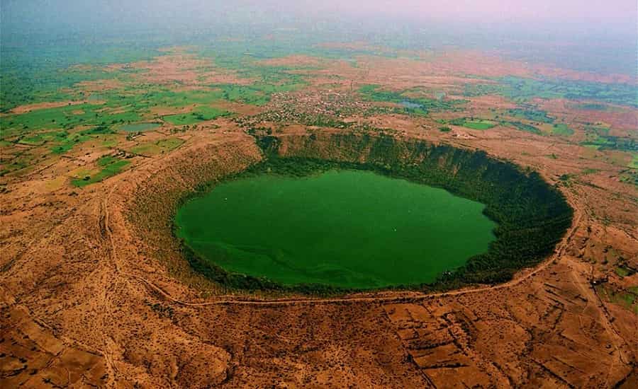
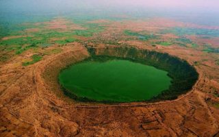
Lonar Lake, in Buldhana district, is one of the world’s best-preserved basaltic impact crater lakes, formed by a meteorite strike rather than volcanic or tectonic activity, believed to have occurred tens of thousands of years ago. Its saline, alkaline water and the surrounding basalt crater make it a site of ongoing scientific study, alongside several ancient temples along its rim.
The crater itself is roughly 1.8 km in diameter, and researchers from institutions like the Geological Survey of India have studied it for decades to understand the impact event. Because of its unusual chemistry, the lake occasionally shows a striking colour change, which has drawn both scientists and curious travellers to this otherwise quiet corner of Vidarbha.
Ambazari Lake
Quick Facts
- Location: About 6 km west of Nagpur, Maharashtra
- How to Reach: About 8 km from Nagpur Railway Station; Nagpur is also well served by air and national highways
- Best Time to Visit: October to February; check current event schedules for any weekend shows
- Suggested Duration: 1–2 hours for the lake and garden
- Area: Ambazari Garden spans about 20 acres
- Sightseeing: Musical fountain, boating; the garden has historically hosted a weekend aero-modelling and seaplane show, though such events can change, so it’s worth checking current listings before visiting specifically for it
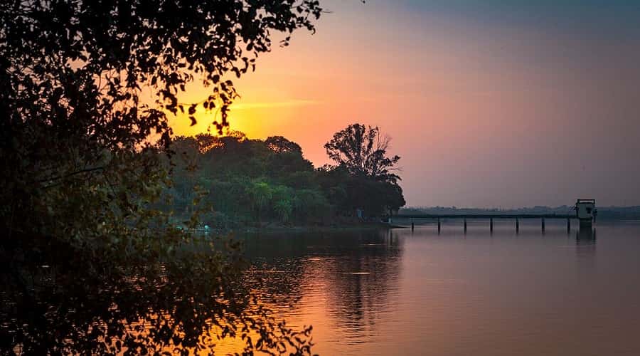
Ambazari Lake sits about 6 km west of Nagpur and is the city’s biggest and most popular lake, known as a favourite picnic spot. The adjoining Ambazari Garden, developed by the Nagpur Municipal Corporation, spans about 20 acres and includes a musical fountain synced to lights and music.
Rajkamal Water Sports Centre runs boating on the lake, and the garden has at times hosted an aero-modelling and seaplane show on weekend evenings — worth checking current event listings for, since such shows are not always a fixed, year-round feature. Nagpur is well connected by rail, road, and air.
Pashan Lake
Quick Facts
- Location: About 12 km from the National Defence Academy (NDA); roughly 10 km from Pune Railway Station
- How to Reach: Autos, taxis, and city buses run from central Pune; Pune is well served by rail, road, and air
- Best Time to Visit: November to February, early morning, for winter migratory birds
- Suggested Duration: About 1 hour for a focused birdwatching visit
- Area: About 110 acres, with roughly 60 acres under tree plantation
- Sightseeing: Birdwatching, especially migratory species in winter
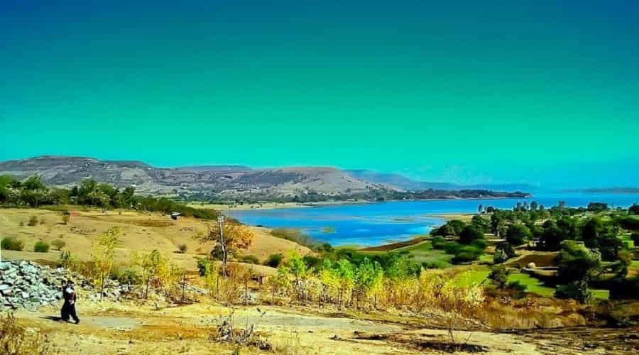
Pashan Lake, roughly 10 km from Pune Railway Station and about 12 km from the National Defence Academy (NDA), is best known as a bird sanctuary, especially popular with birdwatchers during the winter migratory season. It has also historically supplied drinking water to Raj Bhavan and the nearby Sutarwadi and Pashan areas.
The lake spans about 110 acres, with roughly 60 acres developed for tree plantation by the Pune Municipal Corporation. Silt buildup has reduced its depth from around 50 feet at one point to about 20 feet today, a concern for the birds that depend on it. Early morning is the best window for birdwatching, before the area gets busier.
Lakes in Thane — the Lake City
Quick Facts
- Location: Thane city, Maharashtra
- How to Reach: Thane Railway Station is central to most lakes; well connected to Mumbai via suburban rail and road
- Best Time to Visit: October to February; evenings for lakeside walks and food
- Suggested Duration: 30–60 minutes per lake for a casual walk
- Number of Lakes: Around two dozen; check with the Thane Municipal Corporation for the latest count
- Sightseeing: Talao Pali (street food, evening walks), Upvan Lake (couples, lakeside restaurants)
Thane is popularly known as the Lake City, home to roughly two dozen lakes that have made the area attractive to homebuyers as well as visitors. Talao Pali Lake, previously known as Masunda Talao, is a long-time favourite for evening strolls and street food, from bhelpuri to ice cream, with several restaurants nearby.
Upvan Lake is especially popular with couples, with a small park and lakeside seating area, plus several lakeside restaurants nearby. Other lakes in Thane include Ghosale Talao, Siddheshwar Talao, Rewale Talao, Hariyali Talao, Khidkaleshwar Talao, Railadevi Talao, Nar Talao, Kasar Vadawali, Bramhala Talao, Kausa Talao, Makhmali Talao, and Kachrali Lake. A range of accommodation options are available in Thane for visitors.
Ramkund — Nashik’s Sacred Kund
Quick Facts
- Location: Panchavati, Nashik, Maharashtra
- How to Reach: Nashik is well connected by rail, road, and air; autos and taxis cover local transport
- Best Time to Visit: Year-round; especially significant during the Kumbh Mela, held periodically in Nashik
- Suggested Duration: 30–60 minutes, longer during festival periods
- Area: The main kund measures roughly 27 by 12 metres
- Sightseeing: Gandhi Lake and memorial, Kalaram Temple, Sita Gufa, and the wider Panchavati temple cluster
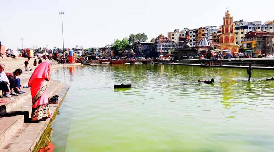
Ramkund is not a natural lake but a sacred bathing tank, or kund, in the Panchavati area of Nashik, holding strong mythological significance — tradition holds that Lord Rama and Sita bathed here during their exile. A dip in this kund is considered deeply auspicious, and it remains a common site for Hindu last rites, believed to help attain moksha.
Local tradition attributes the tank’s construction to Chitrarao Khatarkar around the late 17th century, though exact historical records vary. The kund measures roughly 27 metres by 12 metres, and the nearby Gandhi Lake features a white marble Gandhi memorial; the ashes of several notable leaders, including Jawaharlal Nehru, Y.B. Chavan, and Indira Gandhi, have been immersed here. A range of accommodation options are available in Nashik across different budgets.
Koyna Reservoir (Dam)
Quick Facts
- Location: Koyna Nagar, Satara district, Maharashtra
- How to Reach: About 60 km from Kolhapur, 58 km from Karad, 44 km from Chiplun, and roughly 120 km from Satara city; nearest railway stations are Karad and Chiplun
- Best Time to Visit: June to October for lush monsoon scenery; winter for more comfortable trekking
- Suggested Duration: Half a day for the dam viewpoint and a short trek; a full day if combining with Koyna Wildlife Sanctuary
- Height and Capacity: Dam height of 103 metres; Shivsagar reservoir stretches about 50 km
- Sightseeing: Koyna Wildlife Sanctuary, trekking trails, boat rides to nearby forts

The Koyna region spans the Shivsagar reservoir, Mahabaleshwar, and Satara areas, with a well-known trekking chain running from Mahabaleshwar to Jungli on the reservoir’s western side. The area remains relatively untouched, with many unmarked trails, making it a genuine challenge and reward for experienced trekkers, and ferries on the reservoir also offer boat access to nearby forts.
Koyna Wildlife Sanctuary, covering the dam’s eastern and western catchment areas, is a significant protected forest here, and Koyna Reservoir itself is a major hydroelectric project for western Maharashtra. Construction of the dam began in 1956 and was completed in 1963, with its first turbine operational in 1962; it stands 103 metres high, with the effective water level varying with rainfall.
Koyna is globally significant for reservoir-induced seismicity — the idea that large water impoundments can trigger earthquakes. The magnitude 6.3 Koyna earthquake of 11 December 1967 killed more than 200 people and remains one of the largest such events ever recorded; more than 150 smaller quakes above magnitude 4.0 have been recorded in the area since. Given the remote terrain, rains can make some approach roads slippery or foggy — check local conditions before driving up during monsoon.
Mulshi Reservoir and Venna Lake
Quick Facts
- Location: Mulshi, about 50 km from Pune (on the road toward Lonavala); Venna Lake within Mahabaleshwar town
- How to Reach: Mulshi: about 50 km/1.5 hours from Pune by road; Venna: a short walk from central Mahabaleshwar
- Best Time to Visit: Monsoon (June–September) for Mulshi’s greenery; October to June for a comfortable Venna Lake visit
- Suggested Duration: Half a day for Mulshi with a fort or trek; 45–60 minutes for Venna Lake
- Sightseeing: Mulshi: Tamhini Ghat, Tikona Fort, trekking trails, boating; Venna: pedal boating, horse riding, Mapro Garden and Arthur’s Seat nearby in Mahabaleshwar
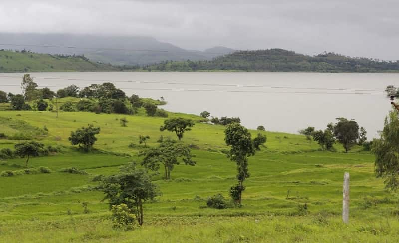
Mulshi Reservoir, formed by the Mulshi Dam on the Mula river, is popular for its monsoon-season greenery, boating, and nearby forts, making it a common weekend destination from Pune — it’s best associated with Pune rather than Lonavala, even though it sits along the general route between the two. The surrounding hills turn a deep green during the monsoon, and several trekking trails and old fort routes, including Tikona Fort, pass close to its banks.
Venna Lake, in the hill station of Mahabaleshwar, is a smaller, more leisurely lake known for pedal boating and horse riding along its banks, framed by the town’s cool, forested surroundings. It’s an easy, low-effort stop for families and honeymoon travellers already visiting Mahabaleshwar for viewpoints like Arthur’s Seat and Wilson Point, and stalls around the lake sell local snacks and the region’s well-known strawberry-based treats.
- Must Reads on: Popular Forts of Maharashtra
Other Notable Lakes and Reservoirs in Maharashtra
A few more waterbodies are worth knowing about, even if they don’t need a full section of their own.
| Lake / Reservoir | Known For |
| Powai Lake (Mumbai) | An artificial lake popular for its lakeside promenade and restaurants |
| Vihar and Tulsi Lakes (Mumbai) | Key drinking-water reservoirs inside Sanjay Gandhi National Park |
| Rankala Lake (Kolhapur) | A scenic city lake known for boating and evening walks |
| Upper Wardha Reservoir (Amravati) | A major irrigation reservoir on the Wardha river |
| Gangapur Dam (Nashik) | A key reservoir on the Godavari, supplying Nashik city |
| Jayakwadi Reservoir (Chhatrapati Sambhajinagar) | One of Maharashtra’s largest reservoirs, also called Nath Sagar |
Lake and Reservoir Types at a Glance
| Waterbody | Type | Best For |
| Lonar Lake | Meteorite crater lake | Science, geology, photography |
| Ramkund | Sacred kund (tank) | Pilgrimage, rituals |
| Ambazari Lake | Artificial lake | City picnic, boating |
| Pashan Lake | Artificial lake | Birdwatching |
| Koyna Reservoir | Dam reservoir | Trekking, scenery |
| Mulshi Reservoir | Dam reservoir | Monsoon weekend trips |
| Venna Lake | Artificial lake | Family outings |
Best Time to Visit Maharashtra’s Rivers and Lakes
| Season | Experience |
| Winter (Oct–Feb) | The most comfortable season overall; best for birdwatching at Pashan Lake and calm visits to city lakes |
| Summer (Mar–May) | Hot and dry inland; hill-station lakes like Venna offer relief, but water levels in some reservoirs can drop |
| Monsoon (Jun–Sep) | Rivers and reservoirs like Koyna and Mulshi are at their most dramatic, though travel and trekking need extra caution |
Environmental Health of Maharashtra’s Rivers
Not every river in Maharashtra is thriving. Smaller rivers and streams near major cities and industrial belts have seen declining water quality over recent decades, largely due to untreated sewage and industrial discharge, a pattern documented by state pollution control authorities across urban Maharashtra.
The larger rivers covered in this guide — the Godavari, Krishna, and Tapi — face their own pressures too, particularly reduced dry-season flow and water-sharing disputes between states, but remain vital sources of irrigation, drinking water, and hydropower for tens of millions of people across the Deccan Plateau.
Frequently Asked Questions
Q-1: What is the coastline length of Maharashtra?
Maharashtra has a coastline of about 720 km along the Arabian Sea, known as the Konkan coast.
Q-2: Which are the major rivers in Maharashtra?
Godavari, Krishna, and Tapi are the major rivers associated with Maharashtra, along with tributaries like the Bhima, Manjira, and Wardha.
Q-3: How many states does the Krishna River flow through?
The Krishna River flows through four states: Maharashtra, Karnataka, Telangana, and Andhra Pradesh.
Q-4: Where does the Godavari River originate?
The Godavari River originates near Trimbakeshwar, close to Nashik in Maharashtra, in the Western Ghats.
Q-5: Which city in Maharashtra is known as the Lake City?
Thane is known as the Lake City, with around two dozen lakes, including Talao Pali and Upvan Lake.
Q-6: What makes Lonar Lake unique among lakes in Maharashtra?
Lonar Lake was formed by a meteorite impact, making it one of the world’s best-preserved basaltic crater lakes.
Q-7: Is Ramkund actually a lake?
No, Ramkund is a sacred bathing tank (kund) in Nashik’s Panchavati area, not a natural lake, though it’s often listed alongside Maharashtra’s lakes.
Q-8: What caused the 1967 earthquake near Koyna Dam?
The 1967 Koyna earthquake is widely studied as a case of reservoir-induced seismicity, where the weight and pressure of impounded water is believed to have triggered fault movement.
Q-9: Which lake in Maharashtra is best known as a bird sanctuary?
Pashan Lake near Pune is well known as a bird sanctuary, especially popular with birdwatchers during the winter migratory season.
Q-10: Is Ambazari Lake worth visiting in Nagpur?
Yes, it is Nagpur’s largest and most popular lake, with boating, gardens, and a musical fountain; check locally for any seasonal events.
Q-11: Is Mulshi Lake or Mulshi Reservoir the correct name?
Mulshi Reservoir is the more accurate term, since it’s a dam-formed waterbody rather than a natural lake, though “Mulshi Lake” is commonly used too.
Q-12: What is a good weekend lake near Pune?
Mulshi Reservoir and Pashan Lake are both popular weekend options close to Pune, for boating/trekking and birdwatching respectively.
Q-13: What is a good lake or reservoir near Mumbai?
Powai Lake and the Vihar and Tulsi Lakes inside Sanjay Gandhi National Park are the closest well-known waterbodies to Mumbai.
Q-14: Is boating available at Maharashtra’s lakes?
Yes, boating is available at several lakes, including Ambazari, Venna, and Mulshi Reservoir; charges and boat types vary by location.
Q-15: Which is the largest reservoir in Maharashtra?
Jayakwadi Reservoir (Nath Sagar), near Chhatrapati Sambhajinagar, is among the largest reservoirs in the state.
Q-16: Can you camp or trek near Koyna Reservoir?
Yes, the Koyna region is popular for trekking, particularly the Mahabaleshwar-to-Jungli trail, though trails are largely unmarked, so going with an experienced guide or group is advisable.
Related Guides
For more on the regions covered here, see our dedicated guides to:
- Most Beautiful Beaches in Maharashtra
- Famous Historical Monuments of Maharashtra
- Popular Hill Stations of Maharashtra
- Wildlife sanctuaries and national parks in Maharashtra
Conclusion
From the Godavari and Krishna river basins to the meteor-formed Lonar Lake and Thane’s cluster of city lakes, the rivers and lakes in Maharashtra reflect the state’s remarkable geographic range, from the Western Ghats to the Deccan Plateau. Whether you’re drawn to Ramkund’s spiritual history, Koyna’s dramatic landscape, or a quiet evening walk around Upvan Lake, these water bodies remain some of Maharashtra’s most rewarding places to explore.
- Also Read: Popular Waterfalls in Maharashtra